sign in a cave in Laos

3 October 2009

Mun Fatt Ngam & Stairway Cave, Perak, video

New graffiti in Gua Kandu


On the second day, we did Gua Kandu first, so I could show Jeroen a 'big' cave. There is so much graffiti in this cave, especially in the lower section (the eye is new since my last visit 2 years ago).

From here we went across the road to Gunung Mesah, and I was surprised to find a new prawn fishing pond at the base of the hill. Approximately 380 steps lead up to the cave, and about 3/4 of the way up, we saw a cave entrance on our left. We had a look and surveyed this small cave, and named it Stairway Cave.

After monsoon rain, we continued onto the top of the stairs to Mun Fatt Ngam. This is an old Taoist temple, known in the 1880s and used by tin miners, then abandoned during or after the Emergency in 1969. Cave is basically one large chamber. We surveyed it.

See Mun Fatt Ngam photos.

Cable Cave & Gua Sanding, Perak, video

Whilst looking for Gua Sanding, we came across a cave new to me, which I named Cable Cave, as someone has intalled a lot of electric cables and light fittings in the cave. It has been done really badly with the cables running down the centre of the passage and the concrete blocks also in the centre. The cave is quite short, but has some nice formations and also some varied cave fauna.

These caves are on Gunung Gajah, and near Gua Tempurung, in Perak.
Note the broken bridge right at the start of the video, which I drove over!

Photos and video taken by The Diving Dutchman, Jeroen Elout.

27 September 2009

Madai Caves - Brunei Times

Local tribesfolk nestling among the Madai Caves

Brunei Times 27 Sept 2009

A river runs through it: The Madai Cave is one of very few in the region to have a river running through it.

The Madai Caves are not as well known as the nearby Gomantong Caves in Sabah, or the caves in Gunung Mulu National Park in Sarawak.

However, Madai has long been an important area for birds' nest collectors and is now becoming better known among tourists looking for adventure.

Situated between Lahad Datu and Tawau, the hill containing Madai Cave itself rises steeply from the forest floor. There are more than 25 caves in this area, but Madai is the biggest and best known. The caves were first visited 60 years ago by scientists who noted how the phosphate deposits from the bat and swiftlet guano were collected and used as a fertiliser.
Madai village

A much older industry is that of birds' nest collection. The local Idahan people have had the rights for collecting birds' nests in the area for generations.

Harvesting birds' nests is a well known industry throughout Borneo, which features many limestone caves that are home to the swiftlets that build the edible nests.

Swiftlet farming is becoming big business. Existing buildings are being converted to bird "hotels", and in some places new purpose-built structures are being constructed. The demand for birds' nests has continued to soar over recent years, especially for the culinary and medicinal markets.

In Madai, the collection of birds' nests is controlled by the villagers who own the rights. As you walk to the cave you pass through Madai village. The locals are the guardians of the birds' nests, and during the collecting season they can offer a place for the nest collectors to stay. There is even a small mosque in the village.

A staircase leads up to one of the entrances. First, you walk through a dark tunnel where there is a grave of an unknown person. This passage leads to the cave entrance, where there are a few houses, used by the men who guard and collect the nests.
house used by nest collectors

There is also another grave. This one supposedly belongs to "Nenek Apui", who was one of the earliest inhabitants here.
grave
Walking into the cave, I was struck by how impressive it is. The ceiling is about 130 metres above, and the chambers are large. There are several openings high in the roof that allow a small amount of daylight to enter.

The floor is covered in guano and it was actually quite slippery walking across the sticky, wet droppings.

There were also lots of small cockroaches running around in the guano, feeding on smaller invertebrates. All around I could hear the clicking of the swiftlets and chirping of insects.

There were a few swiftlets on the floor, and although they presented a good photo opportunity it was sad to know they would not survive.

I was quite surprised at the number of men inside the cave, considering it was not yet collecting season.

The collection is controlled and restricted to twice a year, so as not to deplete the swiftlet population.

There were few ladders hanging in the cave, but more will be installed when the collection begins.

From this part of the cave we went down to the lower river passage, where the river comes pouring out of the hill. This was quite a spectacular sight as there are not many river caves in Malaysia.

We were able to explore inside for a short distance.

Madai Cave was even used in one of the stages of one of the world's toughest endurance race, the Eco-Challenge Sabah 2000, when participants had to climb the rattan ladders.

If you want to visit Madai Cave, it is best to get permission from the District Office in Lahad Datu town, otherwise you have to make arrangements with the Idahan elders.

The cave is certainly worth a visit if you are in that part of Sabah.
The Brunei Times

© Liz Price
No reproduction without permission

--------------------------
See more photos on Madai album.
________________

20 September 2009

Caving in Myanmar - (Wild Asia)

Since going caving in the southern part of Myanmar, or Burma, in Jan 2009, I've written various articles for caving and other magazines.
Here is one short piece that I prepared for WildAsia..

Barefoot In Burma 

After years of closed-door policy to travellers, a rare opportunity to explore Myanmar's sacred cave temples had LIZ PRICE taking off her shoes to experience the dry and muddy 5-day caving expedition.

Written by Liz Price on 18 Aug 2009


In January 2009, I joined two German cavers for a five day caving expedition in the southern part of Myanmar. Some of the caves had been turned into temples so we had to remove our shoes and do our surveying barefoot.
History
Many caves in Myanmar, formerly known as Burma, were visited and documented during colonial days at the end of the 19th and early 20th centuries. Most of these visitors went to the Shan state northeast of Rangoon, and to the Moulmein area in the south. Particularly famous are the Pindaya Caves in the Shan area, and Kaw Gon and Farm Caves near Moulmein. Since then very little work has been done on the caves, and when Myanmar effectively closed its doors to travellers, it was not easy to travel to the limestone areas.
2009 Trip
Our trip was planned to the Hpa An - Moulmein area in southern Myanmar. Permission was obtained from the Myanmar Tourism Promotion Board in Yangon. As required by law, we had an official tourist guide and hired a van and driver for the duration of our stay.
We were met upon arrival at Yangon airport, and immediately drove to the first cave in Hpa An, six hours away. . Hpa An is the capital of the Kayin state in southern Myanmar and although it is possible for tourists to travel there, few do. It is a reasonably quiet town, with no high rise buildings and not much traffic. It lies on the banks of the Thanlwin River.
We spent four days caving in the Hpa An area, then drove south to Mawlamyine, formerly, Moulmein. Mawlamyine is Myanmar's third largest city and capital of the Mon state.
The Limestone Hills
Most of the hills we visited were isolated tower karsts, although we did see some ridge karsts. Mt. Zwegabin is one of the most famous hills at 722m high. It is considered a sacred hill, and has many chedis and shrines and a pathway up to the top.
The Caves
Most of the caves we visited were temple caves, already well known from historical documents. Some of the most famous are the Farm Caves at Moulmein, Saddan Cave, and the Kaw Gon archaeological site in Hpa An.
Many of the caves had impressively large passages, around 20-30 m wide and chambers as large as 60m x 60m. The longest cave was Saddan Cave in Hpa An at 800m.
Each day, we would decide on an area to visit and drive to the biggest cave temple. Then we would ask the monks and locals for information on other caves in the area. We found that the people were friendly and more than willing to help. They didn't question the sanity of three Westerners trekking through all parts of each cave!
Myanmar is predominantly a Buddhist country, although there are quite a number of Muslims in the Hpa An area. Almost all the caves we visited had been converted into a Buddhist temple. In some, just the entrance was used. In others the whole cave had been developed. Some of them had electric lighting, walkways and statues throughout the cave.
Nobody questioned us whilst we were surveying, even though some caves were quite busy with visitors and pilgrims. Footwear had to be removed at the entrance of the temple compound, even if it meant walking on muddy ground before reaching the temple. This is different from countries such as Thailand where you only remove shoes at the inner temple.
The Myanmar caves were quite dirty with rubbish strewn everywhere even though they are sacred sites. People just drop litter, mostly wrappers from candles and incense sticks. All the caves we visited were dry.
Cave fauna
Some of the caves are home to a wide range of bats and invertebrates. We collected samples of cave fauna for identification. The Heteropoda spiders were particularly interesting, and are amongst the largest in the world. Currently, the world's largest spider is Heteropoda maxima from caves in Laos, but the Myanmar specimens may prove to be just as exciting and are currently being identified.
Conclusion
A total of 14 caves were visited and 3.3 km surveyed in five days. It was a good introduction to the area. We succeeded in establishing contacts for further cave expeditions in Myanmar. However, we were warned that Myanmar will be having elections in 2010 and it is unclear if permission will be granted during that time.


© Liz Price
No reproduction without permission


31 August 2009

Sadaw Cave different surveys, Myanmar


16 August 2009

Perak Tong cave temple after the 2009 rockfall

Perak Tong is one of Malaysia's most famous cave temples, located north of Ipoh. In Jan 2009 there was a disastrous rockfall there, which killed one person. Although the tragedy was covered for several days in the press, there was no mention of what had really happened, or suggestions as to the cause.

In August 2009 I managed to visit the cave for the first time since the rockfall. The cave was now "back to normal" in the sense that the staircase up through the cave to the top of the hill has been rebuilt.

Inside the cave there is still construction work ongoing. However there is no obvious sign of what happened and most visitors will probably remain unaware of the rockfall.

I was very curious to see what had happened. I went there with my friend Law Siak Hong. Firstly I took some photos of the outside of the hill where the collapse is clearly visible. It covers a much larger area than I expected. 


Then we went in the cave. There is now a new staircase up through the cave to the back entrance. This area is now much brighter as the top chamber (presumably where the collapse occurred) now allows a lot of light to enter. As we left the chamber with the 3 large statues, on the left we saw 2 new pillars which seemed to be supporting a massive rock.


Hong translated the Chinese writing and said the pillars have just been constructed, this summer. I was stunned - were these pillars meant to hold up the rock, or were they just for 'decoration'.

As we neared the top, we could see parts of the old staircase.

One section was on a huge boulder which appeared to have fallen. From here it looked as if there were 3 enormous rocks which had moved, but they are so large, I couldn't believe that the place has been rebuilt and reopened in around 6 months. One man told Hong that these 3 rocks had moved, but were now wedged naturally in place. We could see a lot of fresh cement joining and covering various rocks.


I was quite stunned at the enormity of the collapse - although of course I am not 100% of what actually happened. I really wonder how safe the place is now, have the huge boulders already stabilised themselves....? What are they actually resting on....? I heard unofficially that no proper safety check was done as it would have been too expensive.


notice at top
Unfortunately I have no photos taken prior to the collapse of the inside of the affected areas of the cave, so cannot compare my photos of before and after.


© Liz Price
No reproduction without permission

Gua Tambun overnight trip 2009

In Jan 2009 I went to Gua Tambun rock paintings to see Noel's erection Gua Tambun scaffolding. August 14-15 he was spending 24 hours at the site to do some data recordings, so I joined him along with Law Siak Hong, Juliana Rahim and her husband Ikmail.

Noel was there from around 9am on Fri morning, and I arrived at 1pm, having had a nice lunch in Ipoh, whereas Noel was heating his chunky soup and instant couscous on a brand new stove.

The others arrived during the late afternoon and time passed quickly as we chatted and had a look around. The pondok at the base of the steps has been constructed since my last visit in Jan, though the info board is still empty, and the roof tiles are already covered in moss or algae.

Noel was taking readings of temperature, humidity and luminosity every hour.


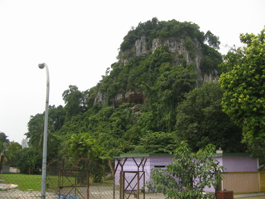
Surprising the site was quite dry as the humidity was around 60% during the afternoon, compared to much higher readings of 90+ in other places such as Penang. The temperature only once reached 33C in the afternoon. The meters were positioned on the cliff face. It was quite hazy and the views to Keledang hills were disappointing.

We had set up tents on the stony floor.


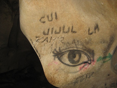
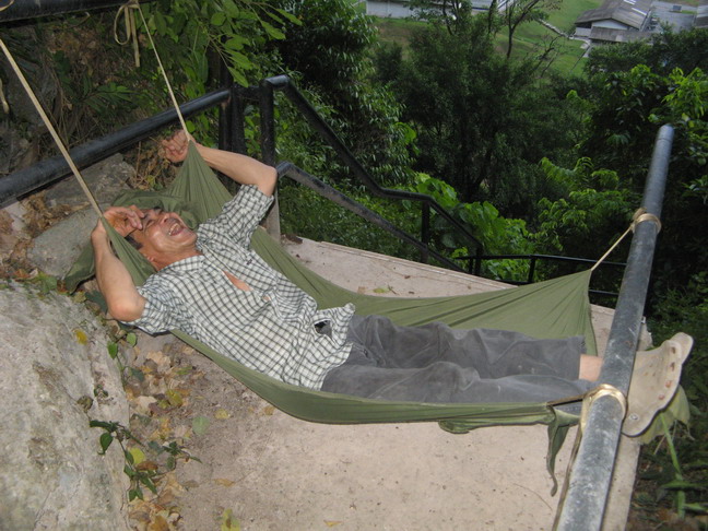
It was the first time I had used my tent since I was in Madagascar in 1999 - luckily it hadn't rotted. Hong put up a hammock on the steps, so we declared him our guard dog. Incidentally there were no signs of the dog family we had seen in Jan. At the end of the cliff area, some people have scattered a lot of textbooks (English and Chinese). We couldn't understand why people would carry books up to this site and then destroy them there.


By 10pm we had all gone to bed, but it was too hot to sleep inside the tent. There was no need for a fly sheet as we were protected from any rain being under the huge overhang of the cliff. At 11pm our peace was shatterd as the soldier boys in the army camp directly below us started karaoke. It was BAD. Really bad. Absolutely awful. It lasted about 2 hours, then after that, there was still noise as stragglers returned to the army camp in cars and noisy bikes.

Also the floodlights from the army camp remained on all night except for one hour. These lights were so bright that we hardly needed torches depsite there being no moon. Part of the cliff face was really illuminated, but luckily not the main area where the paintings are.


Even then it was not a peaceful night as the birds were calling the whole night. I think they are swifts. Why do they spend the night calling when they should be sleeping. I wondered if it was because of the floodlights. Noel had set his alarm for every hour on the hour. Then we heard the loud crunching of his footsteps on the stones as he went to read the 2 meters. So I didn't get much sleep.

We got up around 7am, and the last reading was taken at 9am. We said our goodbyes to the paintings, then left and went to town for breakfast and durians.


examining the paintings with a magnifier

goat droppings


some of the noisy birds


© Liz Price
No reproduction without permission