Caves and caving in Malaysia
When it comes to caves, Malaysia is blessed with many of the world's best: the largest chamber, the longest passage, rare archaeological sites, and diverse cave fauna. LIZ PRICE reviews these hidden Malaysian treasures for adventure seekers and spelunkers.
[Published on Wildasia 27 May 2006]
Caves and Limestone Hills of Malaysia
Malaysia has some of the biggest and longest limestone caves in the world, some are archaeological sites, others are beautiful with stalagmites and stalactites, and maybe underground rivers. Some caves are home to a wide variety of cave fauna such as bats, swiftlets, snakes, and invertebrates.
Amongst the most famous caves in the world are the caves in Mulu National Park, Sarawak, which was inscribed as a World Heritage site in 2001. Some of the caves there are world record holders, such as Gua Nasib Bagus which houses the world's largest chamber - Sarawak Chamber. Clearwater Cave is the 10th longest in the world, at 110km. Deer Cave is one of the world's largest passages. The Niah Caves, also in Sarawak, is a famous archaeological site. A 40,000 year old human skull has been found there, and the rock paintings have been dated at 1200 years. Near Kuching the caves of Bau can be visited.
In Sabah, the Gomantong Caves are renown for their birds' nest industry. It is fascinating to see the local people collecting these nests using bamboo ladders and poles. There are many other caves scattered across Sabah, at places such as Madai, Tempadong, Baturong and the Sapulut Valley. Many of these caves have been used as human burial sites.
In Peninsular Malaysia caves can be found in all states north of Kuala Lumpur. The tropical karst towers occur as steep isolated hills rising from the valley floors. In Selangor the Batu Caves near KL are a famous tourist destination and site of the Hindu festival of Thaipusam. Temple cave and the Art gallery caves are open to the public. Dark Cave is one of the best studied caves in Malaysia and is rich in cave fauna. It is the longest cave in the hill and is open to guided tours : education or adventure tours. Other caves in the hill can be visited by people equipped for caving.
In Perak there are many cave temples which can be visited. Gua Tempurung is a show cave with electric lighting and walkways, and a variety of tour options. It has a fine river passage and some enormous upper chambers. There are other 'wild' caves which can be visited by equipped cavers. The Lenggong area is an archaeological site, home to the 11,000 year old Perak Man, and a 70,000 year old stone tool industry.
In Perlis, Gua Kelam 2 is one of the peninsula's longest caves and is open for adventure cavers, likewise Gua Wang Burma. There are many caves and tin mines in the Perlis State Park.
In Pahang the Charas caves house a reclining Buddha. There are caves at Gunung Senyum and Kota Gelanggi which have been developed for tourism. There are several caves in Taman Negara.
Kedah, Kelantan, and Terennganu also have caves worthy of a visit.
There are more than 500 limestone hills in Peninsular Malaysia, and more than 700 caves, many of which have never been explored by cavers. For a more comprehensive coverage of Malaysian caves, get a copy of the Malaysian Cave Register.
Visiting caves
Caving is a safe sport providing the visitor is properly prepared and equipped. Caves are dark so it is essential for each caver to have at least one source of lighting, preferably a light attached to a helmet such as a carbide light, or else a torch attached by string, leaving the hands free for moving though the cave. Don't forget spare batteries and bulbs. Old clothes and lace up shoes or boots with good soles should be worn.
Some caves may require the use of ladders or ropes, in which case you should only visit accompanied by an experienced caver.
Remember to tell someone at home where you are going and what time you plan to return. Never cave alone, a minimum of 3 people is advised. Take careful note of the route as you travel through the cave, keep looking behind so that you can recognise landmarks on the return.
Caving Etiquette
Do not litter in caves, do not write any graffiti, and do not touch or damage any of the natural formations or rock walls. Do not interfere with the cave fauna.
Cave Conservation
Help us conserve Malaysia's caves. You can contribute by supporting the Malaysian Nature Society. You can also add to our body of knowledge of Malaysian caves by communicating caving reports or any other useful cave-related information to Liz Price.
Caving Contacts
A wide range of useful contacts can be viewed in our Caving Directory. You can also find contact details for the Malaysian Nature Society (MNS) Caving Club and also cave tour ogranisers. If you would like to visit the Dark Caves of Batu Caves, MNS organises educational and tourist trips, I suggest you contact them for more information MNS website.
Need More Help?
If you need more help on getting hold of caving resources (books, equipment, etc), you can learn more from Liz Price's personal website on Malaysian caves and caving.
© Liz Price - article may only be republished with the author's permission.
Books on Malaysian Caves
Caves and Karst of Peninsular Malaysia, by Liz Price (2001) , 98pp.A register which lists all the known limestone hills and caves of Peninsular Malaysia, divided into geographical states. Each entry is allocated a reference number, listing the state, hill number and cave number. There is a description of the karst geology, and tables of highest hills and longest caves. Other pages provide an introduction to Malaysian history and 19th century visitors to caves, as well as archaeology and history of cave exploration. There is a map of the limestone areas, glossary, 16 cave surveys and many photos, and a bibliography of cited references.
Malaysian Cave Bibliography, by Liz Price (1998), 104pp.This bibliography covers the whole of Malaysia, and contains more than 1800 references to Malaysian caves and karst, archaeology, conservation, flora and fauna, geology, geomorphology, hydrology, history, dating from the 1700's to 1997. In addition there is an extensive newspaper bibliography covering 1968 - 1997. Other pages provide an introduction to Malaysian caves and history.
The Natural and Other Histories of Batu Caves, by Shaharin Yussof (1997), 55pp + plates.Describes the various caves at Batu Caves, with information about the geology, ecology and religious significance.

sign in a cave in Laos
18 July 2008
Tarutao Park - WildAsia 2006
Tranquil and Teeming Tarutao Park
[Published on wildasia 2 Oct 2006]
The name means "old, mysterious and primitive" and it was once a haven for pirates, a penal colony and a detention centre for political prisoners. Despite its dubious history, Tarutao is a beautiful tropical island with golden sand, green seas and wonderful sunsets. A mesmerized LIZ PRICE shows you the sites.
We were going on holiday to a place which used to be a haven for pirates and more recently a penal colony and place of detention for political prisoners. The name of our destination means "old, mysterious and primitive". Despite its dubious history and name it turned out to be a stunning place, a beautiful tropical island with golden sands, green seas and wonderful sunsets. We were on Ko Tarutao.
Ko Tarutao is a small island in the Andaman Sea off the west coast of Satun, the southernmost province of Thailand. It is part of Ko Tarutao National Marine Park, which is a large archipelago of 51 islands approximately 30 km from Pak Bara in La-Ngu district, 60 km northwest of Satun town. The islands are north of Langkawi and form part of the same geological group. In fact the main island of Tarutao is only 5 km from Langkawi. These islands are formed of granite and allied rocks, and there is also much limestone. This means caves. The limestone on these islands is the oldest cave bearing limestone in Malaysia, some 450 million years old.
From Satun we paid 250 baht (RM25) for a taxi to Pak Bara. Pak Bara is geared up for tourists and we bought ferry tickets to Tarutao, and visited the Marine Park office. It was an interesting one and a half hour boat ride as we went past lots of scenic limestone islands and saw several dolphins.
When we arrived on Ko Tarutao we paid our entrance fee to the Marine Park and bought a guide book, then organized a room. There is a choice of accommodation from dorms, to twins /doubles, and 2-room lodges. You can also camp on some beaches. Park HQ is at Ao Phante Malaka.
Tham Chorakhe or Crocodile Cave is a tourist attraction not to be missed. A small boat took us up river, past lots of mangroves with occasional limestone cliffs jutting out of the forests. From the jetty a boardwalk leads over mangrove swamps, then steps go down to the cave entrance.
The river enters the cave so a pontoon walkway has been constructed on very noisy polystyrene blocks, which squeaked annoyingly as we walked along. The causeway swayed and wobbled, so I had to make sure I was steady before taking pictures of the stalactite formations. We came to a large dry chamber and we able to explore this with the help of electric lights. It was a nice cave with a lot of stalactites and stalagmites.
The other tourists turned round and went back out, but we were cavers and we could see the far end of the cave ahead, beckoning us. We were separated from it by mud and water but as we were wearing our old caving shoes we thought it wouldn't be a problem. However we weren't expecting the mangrove mud to be so thick and sticky and glutinous. It took a tenacious hold of our shoes and it was a real struggle to move as with each step we sank in mud above ankle level. We were getting nowhere, so decided to give up. Even getting back to the dry chamber was a real struggle, the mud certainly didn't want to give up its grip on our shoes.
Fortunately none of the islands in the Marine Park have been allowed to be developed by private operators. Only 5 of the islands have a regular boat service and only 3 of those are generally visited by tourists, Tarutao, Adang and Lipe. Tarutao is the biggest and has waterfalls, inland rivers, caves, beaches and protected wildlife. Wildlife on the island includes dusky langur, mousedeer, wild pig, fishing cat and crab-eating macaque. In Crocodile Cave we saw crabs and mice. Marine life includes dolphins, dugongs, lobster and turtles. Four types of turtle lay their eggs on the beaches between September and April.
The island was a place of exile for political prisoners from 1939 to 1947 and remains of the prison can be seen on the southern tip of the island, and the middle of the east coast. There is also a graveyard, charcoal furnaces and fermentation tanks for making naam plaa or fish sauce. Many prisoners were revolutionary groups who had held unsuccessful coup attempts. Escape from the island was a disheartening prospect, due to the sharks, crocodiles and fierce guards. The political prisoners enjoyed an open prison atmosphere separate from the common prisoners. One third of the convicts died on the island, many from malaria. During the Second World War, order broke down. Supplies no longer came from the mainland and both guards and prisoners soon became the most feared pirates in the area, preying on merchant ships as they sailed through the Straits of Malacca.
After the War, British naval troops were sent to Tarutao to clean out the pirate groups. The prisons were closed, and villagers from the mainland began to settle on the island and became fishermen and farmers. In 1974 Tarutao became Thailand's second Marine National Park. The villagers were unhappy about this and most moved away, leaving just 17 families.
A road runs down the length of the island. 11 km of its length was built by the prisoners in the 1940's, and the more recent 12 km constructed by the park division. Today the road is mostly overgrown but park personnel have kept a path open to make it easier to get from north to south without having to climb over rocky headlands along the shore.
We decided to look for some other caves we had read about, one of which was Tham Tarun. We walked along the road and it was hard work in the sun especially on a long, uphill stretch. Downhill was OK but we realized we'd missed the cave, as we'd come down to sea level, and saw signboards to beaches and waterfalls. So we slogged back up the hill and explored a small cave we found near the road. We had almost reached the top of the hill when a 10 ton truck came along and gave us a lift back to HQ. We were very thankful.
We did little else that day except swim and look round the information centre and library. Tarutao library is a goldmine of science textbooks and 19th century English literature. The visitors centre has natural history exhibits and information about the prison era, as well as a scale model of the park.
Behind the Park HQ is Toe Boo cliff and this is a great place to climb up to see the views and also the sunsets. It is an area of limestone, with mini cliffs and holes, but no real caves. We were lucky and had glorious sunsets a couple of evenings.
Ko Rang Nok or Birds Nest Island is a small island off the south coast. Locals collect the swiftlet nests for the Chinese market. There are some coral reefs off the island. Sea gypsies and pirates once plied these waters, today fishermen try to make a living.
Ko Tarutao is definitely worth a visit as it doesn't suffer from mass tourism and remains unspoilt. And it is so close to Malaysia, it is easily reached by road and boat.
Facts For The Visitor
Officially Ko Tarutao is only open from November to May when there is a regular boat service from Pak Bara, twice a day. Visitors who show up during the monsoon can stay in the park accommodation if they have their own food. The bungalows can be booked in advance at Pak Bara, or else booked upon arrival on the island. They are more expensive than in other parts of Thailand, and the restaurant is pricey, so make sure you bring enough money - we ran out but lucky the Park staff were willing to change for us. For those who don't want to go alone, tours can be arranged from Satun or Trang.
© Liz Price - article may only be republished with the author's permission.
Caves of Moluccas - WildAsia


Cruising the Caves of the Moluccas
[Published on WildasiaWildAsia 4 June 2007]
Maluku, or The Moluccas, in Indonesia are perhaps better known as The Spice Islands. This name originated from the spice trade during which Indian, Chinese, Arab and later European traders frequented the place from as early as the 1st century. In 1999, the Maluku Islands split into 2 provinces: North Maluku and Maluku. I knew about the caves near Halmahera in the North Maluku province, which had been documented in caving journals, but until my trip to Maluku province in 2007, I had no idea about the caves there.
Although not many cavers have been to Maluku, research has been carried out in several archaeological caves there over the years. Archaeological case studies include the Labarisi site (north Buru), the Hatusua site (southwest Seram), and several cave sites on the northern Leihitu Peninsula (Ambon).
The Siwa Lima Museum in Ambon built a replica cave to represent a prehistoric cave in which people used to live. Inside, visitors can look at cave paintings, a fire place, protective wooden gates, enemy skulls etc.
Caves on Seram
Pulau Seram, or Seram Island, is non-volcanic and is the largest island of Maluku. The capital of the district is Masohi. The island covers an area of 18,625 km2 and its highest peak, at 3027 m, is the Gunung Binaya.
The Manusela National Park covers 19% of the island's width, and has some high and densely forested limestone mountains. The formation of the Manusela limestone has not been precisely dated. I came across two reports; one stated that it is Triassic limestone formed during the Paleozoic and early Mesozoic Eras, while the other report (Cooper) writes that its formation dates back to the Early and Middle Jurassic Period. This is equivalent to 190 to 150 million years ago.
Most of the limestone mountains have been unexplored by cavers and there is one unexplored cave right by the roadside. The caves around the coastal villages of Sawai and Saleman, in the northern parts, are better known. Due to the geological formation of the caves, many of them have deep shafts and canyons formed by underground streams. The water supply for these two villages is obtained from several small resurgences. There is a series of stream sinks on the eastern side of Hatu Lusiala, 3 km to the west of Saleman. Resurgences can be found at sea level and up to a height of 50 m above sea level. The boat ride between Sawai and Saleman offers a good view of the 300 m high limestone hills.
Kampung Saleman is a small Moslem fishing village and tourists are taken to see the evening bat flight from Goa Lusiala. The large entrance is clearly visible high in the cliff of Gunung Polesi behind the village. Every evening flocks of bats leave the cave in an impressive "bat flight". They exit and fly in the shape of a long ribbon over the sea. Unfortunately, the locals seem to think of them as birds, and tourists are taken to see the "Lusiala birds". This 'bird' is sacred to the local community, indicated by its name, 'lusi', which means ancestors, and 'ala', which means descendants. The locals describe these animals as a 'bat-type bird with a tail' and they supposedly leave the cave bearing the souls of the ancestors. The cave is said to be 450 m deep, according to local men who have descended. The SUCC/WCC expedition (see below), however, record it as 80m deep.
Behind the Moslem village of Sawai, there is one cave which is suitable for tourists; Goa Hatu Putih (aka Goa Lasai). It is located within the National Park and is a 40-minute walk away from Sawai. The entrance is in a rock on the hillside, and is a resurgence with 2 small streams coming out. The chamber at the entrance is occupied by fruit bats and non-edible birds' nests. Upon entering the cave, there is a passage with many stal to the left. This leads to a couple of small chambers, which are inhabited by bats and invertebrates such as spiders, whip spiders and ants.
In 1996 there was an international caving expedition to Seram, by SUCC and Wessex Cave Club (WCC, England). They explored many caves in the Saleman/Sawai area and recorded more than 30 caves and resurgences. Many of the caves had deep shafts. According to tourist literature, there are caves near Hatuhuran on West Seram, near Seram Beach Resort.
Goa Akohi, a famous cave in south Seram in Tamilouw, east of Masohi, is full of spectacular stalactites and stalagmites. Large concrete square stepping stones form a path through the cave. The cave is really beautiful. Unfortunately, a new concrete entrance blockhouse has been built over the natural entrance in the last year. Also, electric lighting has been installed recently, powered by a generator located next to the entrance. However, the lights dazzle visitors and the cables were laid without care. Also, much of the workmen's debris has been left in the cave, as well an old concrete staircase. The cave guide found nothing wrong with touching the stal and using them as handholds.
The cave is located right by the roadside and I was told that there are 16 others in the area. The cave is managed by Dinas Pariwisata (Tourism Office). The caretaker can arrange tours for people who turn up at the cave, but it is advisable to pre-book with the Dinas Pariwisata in Masohi before visiting.
Caves on Saparua
Saparua is one of the 3 Lease Islands, which lie northeast of Ambon in Maluku Province, Maluku. Ferries and speedboats leave from Ambon's Tulehu harbour to various ports on Saparua.
The first cave I visited is in Ouw, in the south easternmost corner of the island. I hadn't seen any limestone in the area. Ouw is famous for its pottery. Our drive ended at the far side of the village, from which we walked about 200 m to the concrete steps leading down to a cave. Inside the dark chamber, locals were washing their clothes in the sizeable river. They were using smoky kerosene lamps to light up the place. Unfortunately, they leave their plastic bags, empty detergent containers and toothpaste tubes behind in the cave. The cave apparently leads to the coast which is not far away.
Driving across the top of the island to Kulur on the northwest corner, we passed a cave immediately by the roadside. This may have been Goa Air Serambi. Further on, a local led us to Goa Puteri Tujuh, or Seven Princess Cave. A track led through farmed land with coral karst rocks scattered in the fields. We walked down the steps leading to the cave, and entered a large chamber with several pools filled with incredibly clear water. There were supposed to be seven pools, one for each princess. The water was so clear that, at first, I didn't realise it was water, and wondered why the rocks below were green. I took several pictures but they don't do any justice to the place. Apparently, the pools, which are separated by rock walls, are dry at times of low water. Again, the locals use this cave for washing and obtaining water.
We drove through the village of Kulur and to two caves, Goa Mandi and Goa Minum (washing and drinking caves). The first cave is used for washing and a concrete platform acts as a bathing place. Surprisingly, there were fish in the water. It was murky, presumably from all the soap and shampoo used. The second cave is used chiefly to obtain water and concrete steps lead down to a pump. There is a water tank outside the cave, set up by Mercy Corps in 2002.
© Liz Price - article may only be republished with the author's permission.
References:
COOPER, Ian. 1997. "Seram Geology". SUSS Bull 37/2, The University of Sydney Australia.www.ee.usyd.edu.au/suss/Bulls/37(2)/seramgeology.html
JACKSON, David. "It's a Goa!" Joint SUSS/WCC Seram Expedition Seram, Indonesia: 1st August-7th September 1996. SUSS Bull 37/2, The University of Sydney Australia.www.ee.usyd.edu.au/suss/Bulls/37(2)/seram.html
Gomantong bat caves - in WildAsia
Gomantong bat caves awash in guano


Pagan burials, birds nests and, of course, bats intrigue LIZ PRICE as she pays a visit to the Gomantong Caves in Sabah, Malaysia.
[Published on Wildasia published 7 Jan 2008]
IN FRONT of me was a high mountain of bat guano, made famous by the world famous naturalist, David Attenborough in one of his TV documentaries. This mountain of waste deposit has been formed over the years by the caves inhabitants, the wrinkle-lipped bats. It is estimated that between 600,000 and two million of these flying mammals live in the cave. Each night they leave the cave to feed, and with each bat eating its own body weight in insects each night, this results in several tonnes of insects being consumed per night. No need for chemical insecticides here.
The bats share their dark home with cave swiftlets, and it is these birds which have made the caves famous, due to the harvesting of their nests. The Gomantong Caves have long been known for their birds' nests. Birds' nests, a Chinese delicacy, have been sought for centuries in various caves not merely in North Borneo but in Sarawak and other parts of South-East Asia as well. The greatest single source for these birds' nests has remained the Gomantong Caves. The caves are 32km south of Sandakan, near to the Kinabatangan River on the east coast of Sabah.
There are two main caves, Simud Putih and Simud Hitam. The names refer to the principal types of edible birds' nests produced in each cave, white and black respectively. These limestone caves are about 65 million years old. Although the caves have been known for centuries as a source of birds' nests, the date of discovery of the caves is not really known.
The birds' nest trade probably started around the early 15th century. The Chinese admiral Cheng Ho, a Muslim, commanded a great fleet and supposedly visited Sabah on route to the Philippines in 1406. Around the same time, according to Idahan folklore, an Arab missionary Machdom, known as Alawlia (holy man), came to Sabah's east coast with a trading vessel in 1408. Following this visit, local people began to trade in birds' nests. The Chinese bought the nests and trade flourished. Nests were often exchanged for glass beads, brass, gold and iron, textiles, Chinese stone wares and porcelains.
With the arrival of the first Muslim missionaries, many people converted to Islam. But many resisted, and the east coast caves were important places for spirit activity as burial places for the pagan people. Cave burials took place and the locals treasured the caves as their ancestral burial grounds. In the small, isolated caves not containing edible nests, these customs survived into this century. Unfortunately, few caves with burial remains survived undisturbed over the centuries. In the caves economically important for nests, the hardwood coffins, ceramic and earthenware jars and pots became debris over the years, as well as being removed by the casual visitor. In Gomantong nest collectors built villages right over ancient burial grounds. As people became Muslims, they gave up their pagan customs.
Gomantong Caves were investigated by J H Allard of the China Borneo Company in 1889 for phosphate deposits as a source of fertiliser. The caves were mapped in 1930. Today access to the caves is considerably easier than in the early days, when in 1887 the journey was described as "a long tramp through dense jungle". Today a road leads right to the park headquarters and from there a short walk of just a few minutes brings you to Gomantong hill. Much of the virgin jungle has been replaced by secondary jungle, oil palm and cocoa plantations. But the tall menggaris trees have been left as they are said to be homes for spirits, and are also nesting places for honey bees.
In front of the main entrance to Simud Hitam are the buildings used by the bird nest collectors. The harvesting of nests is strictly controlled and limited to twice a year by licensed collectors. A boardwalk leads into the large gaping entrance to the cave and all around is the twitter of swiftlets as they go about their daily lives. The boardwalk follows the cave walls and in the centre of the chamber is thousands of years of accumulated guano.
Looking closely at the guano I could see it was alive with a whole collection of invertebrates. There were cockroaches, beetles and lots of other insects, all playing a role in the cave's food chain. The cockroaches had made the cave walls their home and in some places, sections of the walls were absolutely covered with them.
Occasionally we were able to get a close up view of a swiftlet which was lying on the handrail or floor. The birds which inhabit the caves and make the edible nests are swiftlets of the Collocalia family, locally called layang layang because of their constant movement. The black and white nests are made by different types of swiftlet. The white nests are made purely of saliva, and are much more valuable and costly than the black nests which have feathers in them. The saliva is produced from a tough, glutinous, translucent substance secreted by the salivary glands.
Most of the swiftlets build their nests high up on the cave walls. The nests look like half a saucer, about three inches long, one and a half inches wide and about half an inch deep. They are firm but springy to the touch. The bigger and thicker they are, the better. As they get old, they become drier and tighten and increase in value.
Collection has been carried out for centuries. The right to collect from certain areas in the cave is based on hereditary rights which are still practiced today. Both black and white nests are found in the dark corners of caves, but the black nests are in areas where light penetrates, generally in immense lofty caverns. White nests are found in truly dark crevices, in low roofed caves.
To reach the nests, rotan ladders with hardwood rungs are hung from the ceiling, held tautly to belian wood. Surplus lengths of rope are coiled up at the bottom. At the top of the ladder, the man ties himself to the bamboo and rotan loops fixed to the ladder. His candle is fixed to a bamboo pole. Nests are scraped from the wall and put into a basket hung on the ladder. During collection numerous small birds and eggs fall. Today bamboo ladders are also used. In some places the roof may be up to 90m high. Although I didn't actually see any men working as it was out of season, it was quite scary just looking at these ladders and thinking how the men work so high above the floor without any safety line.
At the back of the main chamber is a large hole open to the sky which let in a lot of daylight. Simud Putih cave is located high above this entrance.
Leaving the boardwalk I detoured to see Attenborough's guano mountain. I climbed a rocky slope made slippery by the guano, careful not to tread on dying swiftlets and bats which were floundering around on the floor. As the slope leveled out I looked up and there it was, a mountain of guano, maybe 30m high, reaching up in front of me. I felt quite humbled having seen it for myself, something most people would only see on television. As I looked around, listening to the sounds of the bats and swiftlets and dropping water, I felt so small standing in this immense dark chamber. Gomantong Caves is a truly spectacular place.
© Liz Price - article may only be republished with the author's permission.
13 July 2008
Cambodia cave fauna 2008

This is some of the fauna I saw in caves in the Battambang province of Cambodia. All the caves were dry, and some were quite short with daylight penetrating.
 |
| centipede |


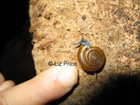


It was interesting to see the cave fauna, most of which is very similar to that in Malaysia. The whip spiders seemed larger than those found in Malaysia.


 |
| Bat Cave |


 |
| baby squirrel |


There are 6 more albums on the Battambang caves -
Caves 1 phnom sampeu and Caves 2 Sdao area and Caves 3 crocodile hill area and Caves 4 kampong poi area and Caves 5 phnom kdaong and Caves 6 Banan area and Caves 7 kpg poi lake area.
---------
© Liz Price
No reproduction without permission
Battambang caves 7 - Kpg Poi lake area 2008
 |
| broken exhaust |
 |
| drink for cavers!! |
 |
| cycad |

 |
| grasshopper |
 |
charcoal |

 |
| chert |
 |
| interesting formation |
 |
| Naga steps |

 |
| how to descend |


 |
| coming up again |


 |
| village shop |

On the second day we saw many entances but most of them were shafts so we couldn't enter. This shaft is 10 m deep -

 |
| one man down |
 |
| 2 men down |
 |
| 3 men down |
 |
| 4 men down |
 |
| all inside |
 |
| chert |
 |
| going back up |


 |
| monk uses this tree to climb down |
 |
| this one uses an old branch |
 |
| coming back up |


The lake was built by the Khmer Rouge and is now used to irrigate the rice fields -


 |
| someone's lunch |


 |
| lotus heads |

 |
| irrigation canal |


There are 6 more albums on the Battambang caves and 1 on cave fauna
Caves 1 phnom sampeu and Caves 2 Sdao area and Caves 3 crocodile hill area , and Caves 4 kampong poi area and Caves 5 phnom kdaong and Caves 6 Banan area and also Cambodia cave fauna .
-------
© Liz Price
No reproduction without permission
Subscribe to:
Posts (Atom)