sign in a cave in Laos

25 February 2009

Myanmar - chert in limestone caves


These formations are probably chert (amorphous silica). Saw these in caves in Myanmar.

Padon Cave -


This is in Padamyar Gu (Ruby Cave)
© Liz Price
No reproduction without permission

12 February 2009

Saparua, Maluku - BT

Saparua: An Indonesian isle of harmony

Highly strung: Saparua's 'rumah adat' was built without using nails. The wood pillars, joists and rafters have been tied with natural string. Picture: Liz Price

Sunday, February 8, 2009

AS OUR speedboat approached the island of Saparua, I was surprised to see a new church with an extremely tall cross dominating the waterfront. The beach was lined with prahus boats and the cheerful locals waved as they hoisted the small triangular sail and set off across the bay.

On arrival, our boat was tied to the jetty and as soon as the waiting angkutan (bemo) drivers saw my white face they all tried to get my custom. They were out of luck as my transport had already been arranged by my companions.

It had taken one hour to make the crossing from Ambon to Saparua. Pulau Saparua is one of three islands forming the Lease group, situated to the east of Ambon in Maluku province, Indonesia.

The island Saparua is shaped like a distorted "H" and has roads covering each of the four peninsulas. Being part of the Spice Islands, the main products include nutmeg and cloves, as well as palm sugar and root products. Most people live as farmers or fishermen, unless they have jobs as government officers or teachers.

As we drove through the capital, also called Saparua, I was surprised to see many churches. Although Indonesia is the world's most populous Muslim country, the Ambon area of Maluku is home to many Christians. It's common to see a mosque next door to a church. Around the island there are a few Christian shrines, and also murals painted on walls, some with the word amato, meaning "go safely", and others more amusingly with Happy Christmas as a permanent feature.

Our first stop was Pattimura's house. Pattimura was an Indonesian national hero from the early 19th century and the house has been turned into a simple museum. There is a locked room containing a display cabinet of Pattimura's clothes. The houses in this town are all bungalows, many of which have thatched roofs made from sago leaves.

Driving through the market was interesting as the traders were just sitting in the road with their wares laid out on the ground. There wasn't a lot on offer, a few piles of durian and other fruit, and some yellow fish I hadn't seen before. Dogs strolled by but made no attempt to grab anything.

Saparua is famous for its biscuits, mostly made from sago. Some were quite okay whereas others resembled a small wad of compacted sawdust.

Our next stop was Fort Duurstede. Today just the shell remains, sitting atop a coral hill. It was built in 1676 by the Dutch Governor of Amboina (Ambon) and was later conquered by the hero Pattimura. During this attack, all the Dutch soldiers were killed. Some canons remain, facing out to the bay and cows graze on the grass inside the fort. The stone-walled lockup still remains.

Driving along the southeastern coast, we went through Sirisori, which is divided into Christian and Muslim villages of Sirisori Kristen and Islam.

Just beyond is Ouw, a village famous for its pottery. The potteries are family run and at the one we visited, we were able to watch the lady quickly and skillfully make two pots. The husband was firing some pieces in the kiln.

One of the main items made are the bowls used for papeda, which is the glue-like sago pudding eaten with fish sauce. Some of the items for sale caught my eye, in particular the large vases with intricately carved flower designs.

Having an interest in caves, I wanted to see Ouw Cave. Steps lead down to the entrance, and inside I was surprised to see three locals sitting in the subterranean river, washing their clothes. They use this cave as a water supply, washroom and laundry. The cave is quite dark so the people use homemade kerosene lamps. The water entering the cave was crystal clear, and it was sad to see all the empty detergent and shampoo wrappers left strewn around the cave.

Back in Ouw, we stopped to look at the ruins of the fortress, and I could see at least four churches in one road. It was amazing that such a small village would have so many places of worship. And then just outside the village a new mosque and church were being constructed side by side.

We then went across to Tuhaha and to the oldest church at Noloth. It was built in 1860 and the roof is made of sago palm leaves and amazingly it survived the riots. It was interesting to see an original stone inscribed "bait Allah detahbiskan oleh R.Bossert 1860" (God's house consecrated by Bossert).

Near the church is the rumah adat, which was constructed without using nails. The wood pillars, joists and rafters have been tied with natural string and the sago sheets used for the roof are tied to bamboo supports.

We headed for Kulur on the western side of the island. On the way we stopped to look at Goa Puteri Tujuh. This cave has amazing clear water pools. There are seven, one for each princess. I couldn't believe how clear the water is, and again the locals use the cave for washing.

We went on to the end of Kulur, to Goa Mandi and Minum. The first cave is used for washing and has a concrete platform where the locals can sit. I was surprised to see fish swimming in the soapy water.

The drinking cave is very clean, steps lead to the middle of the pool. Mercy Indonesia has even built a water tank outside.

Booi is the last village on the southernwestern peninsula. The road ends before the village and then you have to walk in. The village is built on the hill slope leading down to the sea and concrete steps connect the different levels, giving it a terraced effect.

After a full day of sightseeing, we went back to the main town and had a delicious dinner of fresh fish. We were all tired and went to bed early as the next day we would have to be up at 5am to catch the ferry back to Ambon.

It had been a great day.

The Brunei Times


Luang Namtha, Laos - Brunei Times

Roger posted a blog on OneAsean about the Luang Namtha area, and this was of interest to me as I've written a few things about this great area. One of these is below, see also
http://www.bt.com.bn/en/classification/life/travel/2007/07/22/trekking_in_cool_unspoilt_northern_laos
Published on The Brunei Times (http://www.bt.com.bn/en)

Eco-tour treats await in Laos

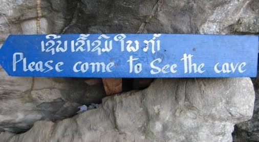
Hole-in-one: Among the many natural spectacles in the Luang Namtha province are the Tham Nam Eng cave (Top), with its 'cavernous' entrance and passageways, and local ethnic minority villagers, who have not forgotten their traditional costumes and customs.Pictures: Liz Price

Sunday, February 1, 2009

LUANG Namtha Province is one of the hidden secrets of Laos. It's an area rich in biodiversity and is unspoilt by mass tourism. All the tourists who go there have made the effort to reach this beautiful part of Laos. It's not the easiest place to get to as it isn't on any major routes. Tourism is still on a very small scale and fortunately the area is not on the itinerary of tour groups, making it a great place for eco-tourism.

Luang Namtha is in northern Laos, and borders China and Myanmar. The main city in the province is also called Luang Namtha and lies on the banks of the Namtha River. To get there by bus from the World Heritage city of Luang Prabang in the south takes between nine and 12 hours. Alternatively, it takes five to six hours to arrive from Huay Xai in Bokeo province, which is the border crossing to Chiang Khong (Chiang Rai) in Thailand.

Most of the eco-tourism activities are based around Luang Namtha. However, Vieng Phoukha to the south is a small town — or more accurately, a large village — which also offers similar adventure tours.

Trekking is the main activity, but you can also participate in mountain biking or kayaking. Any of these options gives you a chance to see the beautiful landscapes and meet the wonderful local people. I found the people fascinating. They belong belong to a whole range of ethnic minority groups and many of them go about daily life wearing colourful traditional outfits.

As we venture around the market, our guide points out the different tribal costumes and hats. There are about 14 ethnic groups living locally, with the main ones being the Akha, the Hmong and the Khmu. Over the years, local tribespeople have migrated throughout Burma, China, Laos, Thailand and Vietnam. This mix is reflected in the physical features of the local people. They all look quite different from each other as there are many different ethnic groups living here.

The women from different groups wear their hair in distinct styles, with or without ornaments. Some men sport colourful jackets, but generally the children dress in western-style clothes.

Trekking is strictly controlled and it is illegal to take an unlicensed guide or to trek independently. This prevents tourists getting lost, and more importantly it stops them from offending the local people's tribal customs. It also helps in that it sends the message to the local people that they, their culture and their natural resources are important and have value. They learn that tourists like to trek through forests, and therefore forests should be left uncut.

There are a couple of agencies in Luang Namtha that offer trekking and other tours. In Vieng Phouka, the Eco-Guides office arranges treks. This area is the newest trekking area in Laos, and the Eco-Guides service is a community-based scheme being helped by the provincial government and the European Union. They currently offer four treks, ranging from one to three days, which visit various ethnic minority villages.

Participating in these eco-tourism activities gives the villagers an income, and also contributes to wildlife and forest conservation projects through access permits.

Laos is one of the poorest countries in the world. As we start our trek, we meet a trio of girls carrying nets and baskets. Our guide explains that the girls are looking for animals to catch. These people eat virtually any animal that they can find, and so they search the rice fields and forests. They use bamboo traps to catch birds and small mammals and they go into caves to hunt bats.

Caving is another activity that can be done in the Vieng Phouka area. Tham Nam Eng is very impressive, with very large chambers and passageways, and lots of beautiful stalagmites and stalactites.

At night, you sleep in ethnic villages. The houses are basic: there are no bathrooms and no running water or electricity. You use the river for washing and the village has a communal water pump and toilet. The nights are noisy with people coughing, dogs barking and chickens clucking.

Luang Namtha's Nam Ha Protected Area was named an ASEAN Heritage Park in 2005. It covers 2,224 square kilometres of unspoilt land ranging from lowlands to 2,000-metre peaks in the northern highlands. The park includes some of the most significant and largest contiguous wilderness areas in the country.

The terrain is quite mountainous, and mountain biking is an increasingly popular activity. The roads are virtually traffic-free and it's a great way to see the countryside. Most tour companies rent out bikes.

For those who prefer playing on water, kayaking and rafting in the province is some of the best in Laos. Negotiate rapids whilst passing lush forests and ethnic villages, or for something more sedate, why not settle for a boat trip on the Namtha. From Luang Namtha, drift downriver to the Nam Ha Protected Area and see Khmu and Lanten ethnic villages along the river banks.

The area also offers much for lovers of flora and fauna, especially birdwatchers. In fact, there is something for everyone who has a love of eco-tourism. And as it is still unspoilt by mass tourism, now is the time to go. Once the new highway opens between China and Thailand, it will bisect this amazing corner of Laos and change the landscape forever.

The Brunei Times