sign in a cave in Laos

27 September 2008

Caves in Battambang Province, Cambodia - WildAsia

Caves in Battambang Province, Cambodia

Little is known about the caves and karsts of Cambodia. LIZ PRICE joined a German team on an exploratory expedition to Battembang Province.

Published on Wild Asia.


There have been very few caving expeditions to Cambodia and until recently little has been known about the karst and caves there. Reasons Cambodia has not attracted spelaeologists include the instability of the country resulting from wars, the Pol Pot regime and also the dangers from landmines.

Pol Pot's insane regime during which thousands of Cambodians were killed only ended in December 1978. A civil war then followed for the next 20 years. Thousands of mines were planted, along roads, in rice fields, in fact almost everywhere. Thousands more Cambodians died from the fighting and from the landmines. Peace only resumed in 1991 when King Sihanouk returned.

At the end of 1995 a German expedition looked at caves in Kratie and Kampot. In 2004 I went to Cambodia as a tourist and went to the "Killing caves" at Battambang.In June 2008 I joined a small scale expedition to explore the caves and karst of Battambang province. The team consisted of 2 Germans and myself.

In 14 days of caving, 65 caves were registered, and 54 of those were visited and 45 of them mapped. A total of 4,253 m of passage was surveyed. This was pretty good going.

In Battambang province the limestone extends from west of Battambang town and continues west towards Pailin on the Thailand border. The landscape from Battambang to at least Sdao is totally flat with the karst hills rising up to 300m from the plain. All the caves we looked at were dry, even though it was the rainy season.

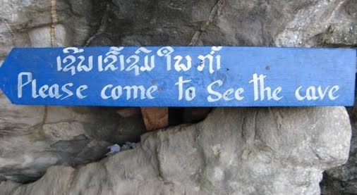
The studies were conducted in cooperation with the Ministry of Culture and Fine Arts in Phnom Penh, and the Museum of Antiquities in Battambang. We hired a vehicle and driver and each day drove to the hills and asked the locals for caves. At first we were only taken to temple caves and other caves containing Buddhas, until we made it clear that we wanted all caves, not just religious sites.

However we soon found that the caves at the tops of the hills were generally small, sometimes they were just cavities. As it was so hot and sweaty to get to these caves, we then asked only for foothill caves.

The road No 10 from Battambang to Phnom Sampeu was in terrible condition in 2004. I hoped it would have improved by 2008, as it leads to the Thai border, but if anything it was worse. It took almost an hour to do the 14 km to Phnom Sampeu. Phnom Sampeu is the famous hill all the tourists visit, as it contains the killing caves and has some wats on top. I found in the 4 years since my last visit, a lot of money has been donated (mainly from overseas) to make new shrines, stupas, Buddha statues, signboards etc. Yet a lot of Cambodians are lucky if they live on $1 a day.

Some of the caves we visited were so full of bats we couldn’t enter, because of the stench of guano (and possible histoplasmosis). At one cave the smell was like pure ammonia, produced by the resident free tailed bats (Tadarida spp.).

It was good to see the bats in the caves however, because in the caves in northern Laos, most of the bats have been caught for food, and we were lucky if we saw just one or two bats. Bats support the rest of the food chain in caves. The caves in Battambang were home to a few invertebrates, such as centipedes, long legged centipedes (Thereupoda), crickets, millipedes, spiders and whip spiders (amblypygids). We found a snake in one cave, a striped kukri (Oligodon taeniatus), but this was probably an accidental visitor.

On 3 caving expeditions to northern Laos, it is obvious that the locals (mainly Hmong minorities) eat any wildlife they can catch. The markets each morning were a great place to take photos of wildlife, there were rats, squirrels, moon rats, porcupine, bats and many types of bird. In Cambodia's Battambang province, I found no evidence that the people eat the wildlife, and unlike in Laos, we saw birds flying around.

Laang Spean, Bridge Cave, is an archaeological site dug in the 1970s. Finds include stone tools from 6000-7000 BC and pottery from ~4290 BC, as well as animal bones. We visited another nearby cave and found some pottery, bones and stone tools, which were taken by the Museum guys.

A full expedition report will be published in due course, and another article will appear in the British caving magazine Speleology in Autumn 2008.

© Liz Price - article may only be republished with the author's permission.

21 September 2008

Tin dredge, Perak - Brunei Times

Historical tin dredge gets facelift to attract visitors


Dredging up the past: (Top to Bottom) The 4,500-tonne tin dredge at Tanjong Tualang, Perak. It was opened in February 2008 to the public for tours. During the heyday of the tin mining industry, Malaysia was one of the world's leading producers of tin. Picture: BT/Liz Price

Liz Price
PERAK, MALAYSIA


Sunday, September 21, 2008


AS we approached the dredge, it looked like a colossal metal monster sitting in a pond, like a relative of a dinosaur. It looked too big to possibly move, but these massive dredges devoured swamp and jungle as they searched for tin deposits.

Tin mining is one of Malaysia's oldest and most successful industries. In the 1600s, this industry was beginning to thrive in Kedah, Perak and Selangor.

Over the centuries tin was extracted in huge quantities, from both open cast and deeper mines. Dredges were commonly used.

Today there are only about three old dredges left in Malaysia, and this one at Chenderoh, near Tanjong Tualang, Perak, has been preserved. In February 2008 it was opened to the public for tours.

Walking onto the tin dredge was like stepping back in time. The cavernous interior was strangely silent, but I am sure that when this dredge was in full operation the noise and vibration would have been almost unbearable. This huge metal monster is a relic of the past, a reminder of the once bustling tin mining industry which thrived in Malaysia.

The dredge, TT No 5, was given a US$30,000 ($42,819) face lift by the company Osborne and Chappel, and Steven Ng is the man responsible to renovating this giant.

Osborne & Chappel was started by British engineers in Malaya in the 1890s and developed the alluvial mining industry in Malaysia. TT5 was built in 1938 by WF Payne and Sons (UK), and modified 1960.

We walked onto the dredge and I realised just how big it is. The pontoon is 75m long and 20m wide and three storeys high.

It is essentially a floating factory where buckets on a chain scoop earth deep from the pond, these buckets are then transported up to an area high in the body of the dredge.

Our guide opened a hatch in the wall and revealed the buckets on the ladder which takes them to the top of the dredge. It looked like something from a bizarre fairground ride.

Each bucket is huge, made of manganese steel and the edges are reinforced to endure the damage done when scooping up the earth containing the tin.

There are 115 buckets on the ladder and each one can hold more than 600 litres. The maximum digging depth of this dredge was 31 metres. At the front end we could see the buckets where they come out of the water before beginning the long ascent to the top of the dredge. We were able to go up to the upper levels to get an overall picture of how the dredge worked. The dredge weighs 4,500 tonnes and was moved by means of a 1.5-kilometre long cable, worked from the control area.

At the top of the dredge, we had a literal birds' eye view over the surrounding ponds. I was surprised to see a few birds nesting in the dredge. There are three ponds in the vicinity and the one TT5 sits on has been surrounded by paths and earth embankments.

Fish have been stocked in the neighbouring ponds which will hopefully encourage more birds in the area.

From the front end of the dredge we walked along the narrow walkway on the roof and entered the next area where we had a close up view of the buckets as they ascended to the very top.

Further on we could look down on the jigs. Leaving the buckets the excavated material is broken up by jets of high pressure water as it falls on to the revolving or oscillating screens.

The large stones and rubble are retained by these screens and the tin bearing material passes to the jigs.

These are vibrating trays, and water is forced up from below, pulsing up in a wave, so the heavy tin sinks down and the lighter hematite floats off.

From this primary separating plant, the tin goes down to the palong below and into a big container ready for transportation.

The waste goes out via a disposal shute at the tail end of the dredge and is dumped on the banks. These tailings are bulky as excavating one cubic metre of new ground produces 20 cubic metres of waste material, as the new ground is compact, but the waste is separated and full of water.

The dredge operated 24 hours a day, there were 3 shifts of about 17 men. An area near the jigs was designated as the eating area where the men had their food. A selection of tools is now exhibited here.

Back at deck level, we could see the many hoses above our heads which carried the tin from the jigs to the collecting areas and could get a better understanding of how the process worked.

We continued our tour around the back end of the dredge and had a look at the control area. On the wall here is a list of the major components of the dredge and the date they were installed and last serviced.

There are squat toilets on the dredge at the back end, which open directly to the pond.

After our tour on the dredge, we walked around the outside and then went to the small exhibition room. During the heyday of the tin mining industry, 40 dredges were operating in Perak, with a record of 105 working in 1929. This particular dredge stopped work around 1983 after more than 40 years of service.

Future plans will see the setting up of a living museum, with people dressed in traditional clothes, with women dressed as "dulang" washers. A video will also be shown on how this giant worked.

A visit to this dredge is an ideal way to get some understanding of one of Malaysia's most important industries.

The Brunei Times

----------------------------------------------------------------------

Source URL:
http://www.bt.com.bn/en/en/travel/2008/09/21/historical_tin_dredge_gets_facelift_to_attract_visitors

3 September 2008

Krachaeng, Yala (caves Thai www)

THAM KRACHAENG, YALA

By Liz Price, 2002

Tham Krachaeng is the 6th longest cave in Thailand at 5633m long and is situated near Ban Than To in Yala province. Ban Than To is roughly halfway between Yala and Betong on route 410. From Betong it is 79 km by the old road, 62 km by the new one. Than To is a small town with a strong Moslem influence. It has a hospital and a fisheries department. Khao Tham Krachaeng is a large limestone hill to the north, and Bang Lang National Park lies to the northwest. This is an area of tropical rain forest.

The Tham Krachaeng system is situated near Ban Than To. More than 5 km was explored and surveyed during 1993 by British, Australian and Malaysian cavers, resulting in a length of 5516m. Only the active part of the system was explored and a high level fossil passage was seen but not entered. In December 2000 some British and German cavers pushed a side passage, the cold water inlet, but were only able to survey 117m as the following day the cave was in flood. There are two main entrances, the side entrance sink, Tham Lod, and the resurgence, Tham Krachaeng. By road these are 10 km apart. The main river sink is situated a few kilometres away south of Ban Than To, near Ban Pu Yut, but is impenetrable to cavers. Tham Krachaeng survey


Tham Lod entrance - From Ban Than To go north about 5 km to Bang Lang National Park. A few metres south of the bridge before the park, turn right and follow the track for about 2 km, turning left at a small bridge. The track ends at the river which leads to the cave. Tham Lod is a sink and a 620m long passage leads to the main confluence. This passage is very flood prone and great care should be taken during the rainy season.

Tham Krachaeng entrance - go north from Ban Than To, through Ban Ka Sod, then right following the signs. Krachaeng Arch is a 100m long natural arch. Follow the river upstream to the main cave entrance. The entrance is blocked by gours so you have to climb up and over them. The large river passage can be followed to a boulder choke and a route up leads to the continuation of the passage and then the confluence with Tham Lod. The upstream Krachaeng water is noticeably warmer than that in Tham Lod. The cave is generally a straight line passage running S - N. It is constantly large and has some fine flowstones and gours. The upstream boulder choke has been pushed 3 times but remains impenetrable. We have tried to enter the cave from the upstream side where the river sinks, but again this is impenetrable.

Notes - There are 2 spellings used : Krachaeng and Krasang. The river caves are very flood prone as they are part of the catchment for the Bang Lang park. The caves should be avoided during unsettled weather. The monsoon season here is Dec - Jan.

Other caves: Tham Wat Krachaeng, aka Tham Morakhot (Emerald Cave) Go through Krachaeng Arch. Steps lead up to the Buddhist temple which was constructed in 1995. The cave consists of one large chamber, and a climb at the back leads up to a tunnel about 20m long. Upper Meditation Cave Situated above Tham Morakhot. A huge chamber slopes steeply up, and a wooden ladder leads up to a higher chamber which leads to a back entrance. This is used by the monk for meditation. There is a parallel passage with some fine formations. Tham Hma (Dog Cave) Just north of the Ban Lang Park, the entrance can be seen by the left side of the road. Cave was explored in 2000 and is about 120m long.

Nearby attractions : Bang Lang dam - the first hydro-electric project in the southern region. There are magnificent views and recreation facilities including fishing. Bang Lang National Park - includes the 9- tiered Than To waterfall. Sakai Village - a village inhabited by indigenous people. There is a small museum and souvenir shop.


Posted on Caves of Thailand www by Dean Smart and Matt London, 2001.