sign in a cave in Laos

9 June 2008

Batu Maloi - Star 2004

The cave that wasn’t
By Liz Price

Originally published in The Star on Saturday March 27, 2004

When is a cave not a cave? That of course depends on whom you ask. Generally a caver will say a cave is a natural opening in rock big enough for a human to enter. Most caves are in limestone formations. So I was sceptical when I kept coming across tourist leaflets which described a cave in Negri Sembilan as being 1km long.

I knew there were no limestone outcrops south of Kuala Lumpur, and I couldn’t imagine that there could be such a long cave that Malaysian cavers hadn’t heard of.

There was only one thing to do to satisfy my curiosity – go and investigate.

I found a willing victim – sorry, volunteer – to accompany me. My friend Mick is not a caver but I told him he could enjoy the day out in a forest reserve and wait in the sunshine while I explored any cave I might find.


The writer wading through the rush of water between boulders.


Pinpointing the location

So one bright morning we set off for the wilds of Negri Sembilan.

According to the tourist leaflets, the Batu Maloi Cave was in the Kampung Tanggai Forest Reserve in the Johol sub-district, 35km from Kuala Pilah. But they neglected to say in which direction from Kuala Pilah, and didn’t mark the reserve on the map!

Another write-up said the cave was 10 minutes from Johol and 30 minutes from Tampin. Well, at least from this I could roughly pinpoint the position.

I assumed the 10 minutes was by vehicle rather than by Shank’s pony.

We set off from Kuala Lumpur to Seremban, and then turned onto the Rembau road. From Rembau we went left onto the Johol road, and climbed up and over a big hill, which was covered in virgin rainforest.

The 884m Gunung Rembau was on our right. It was sad to see the forest alongside the road being cut, presumably for road widening. As we sped down the hill from the summit, there was a police roadblock at the bottom. I think the police were surprised to see two Mat Sallehs on this country road and just waved us through.

As we reached Johol and headed for Tampin, I made a note of time and distance, so I could estimate roughly where Batu Maloi was. After some time, I thought we had overshot.

So I stopped and asked some workmen, and we went back to Renggoh and turned off by the school. Six kilometres down this road, we finally saw a sign to Gua Batu Maloi.


A cluster of fragrant blossoms belonging to the Saraca, a common riverine tree.


Granite, not limestone

There were cows ambling down this lane and they made no effort to get out of the way, not expecting visitors mid-week. The lane ended near a surau, at a pleasant campsite situated by the river.

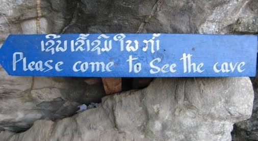
A signboard announced that there was indeed a cave, and as I suspected, it was of granite. The board also highlighted the dangers of caving.

We followed the path into the campsite and then got a bit confused as to the way on. We chose a trail which followed the river. We came to a junction after a short while, and I saw a few large boulders by the water.

This looked like the start of the so-called cave and an arrow marked the way in. But neither of us wanted to get our feet wet this early on, so we elected to take the forest path, to see where it went.

It meandered gently uphill, and after a while we noticed a very pleasant smell, which reminded us of honeysuckle. Looking round for the source, I noticed some orange flowers high in the tree canopy.

Then we spied a few flowers closer to us, almost at ground level. This orange blossom belongs to the Saraca, which is a common riverine tree. Although the individual flowers are nothing special to look at, together they provide a bright orange canopy, and their scent is very nice.

Impressive monolith

I was keeping an eye out for leeches, as this was ideal territory for them. Luckily they didn’t seem very abundant. This suggested there weren’t many mammals around in this area, and indeed we saw none, not even monkeys.

We came to a dilapidated wooden shelter later. I wondered who had had to carry all the materials up here to build the shelter, which had fallen apart through neglect.

Nearby was a huge granite boulder. This isolated monolith was about 8m high and 15m long. It was a very impressive sight.


The writer's friend Mick gets dirty scrabbling up and down some muddy slopes.

Mysterious creature?

After a while the trail began to descend. We soon reached the river, and I could see we were above the start of the cave. We decided to continue upstream for a short while, just to explore. We stepped into the clear water and paddled upriver. In this way we got rid of the few leeches that had attached themselves to our feet. Birds were singing on either side of us, and the sun shone brightly though the thick foliage of the tall trees.

We came across another cluster of Saraca trees with the same sweet scent. There were fallen logs covered with bracket fungi. At one point we saw an animal’s footprint in the mud, and were very puzzled as we only saw one print. What mysterious creature had left it?

Frogs plopping

The shady spot under the Saraca trees would have been an ideal place for a picnic, but we had nothing with us. So it was time to turn round, and go and investigate the cave at the huge boulders situated in the riverbed. Arrows painted on the rocks marked the way through, although in fact there was only one route here.

This section of cave was a mere 15m long, and had natural light filtering through. Mick, my friend, however decided he would go around the outside and meet me at the other end.

I soon popped out of the first section of cave and plodded downstream to the next set of boulders. Here the cave was a bit narrower and I was glad to have my torch.

A rope showed the way through, and I found the first section had quite deep water. The rush of water between the boulders and the plop of frogs as they jumped into the water when I disturbed them was quite atmospheric.

In the next part, I decided the water was possibly too deep to keep my daypack dry, so I hauled myself up and over some huge boulders and carefully inched my way across the top and down the other side.

Somehow I managed to slip the last few feet and landed in deep water. Luckily I managed to keep my camera dry.

It was fun negotiating this natural obstacle course. It was as if some giant long ago had been playing marbles with these huge stones, and had lost interest and left them scattered in the river bed.

I went through the final section of cave, and found Mick waiting for me on the other side. He had managed to get rather dirty, scrabbling up and down some muddy slopes. We had both had fun.

As suspected, Batu Maloi wasn’t a cave in the true sense of the word, but it was an interesting place and worthy of a visit.

Climbing up Batu Caves Hill - Star

No pain, no gain

By Liz Price

THE STAR Lifestyle
Saturday June 12, 2004

Everything I didn’t like was attracted to me that afternoon. The mosquitoes were pestering me. The sweat bees were buzzing around me, and ants and seemed to occupy every branch I grabbed hold of. The sharp rattan endeavoured to entangle me while jagged limestone rocks stood waiting to cut me should I fall against them. Thankfully, we didn’t see any leeches.

No, we were not in some remote jungle. We were at Batu Caves, just a mere 12km from Kuala Lumpur.

Every now and again, a few like-minded souls give up the comforts of their home to spend a day exploring this sometimes inhospitable terrain. Our goal – new caves. And surprisingly, there are new caves waiting to be found, even as close as KL. Batu Caves hill is an ideal place to look.


The climb was tough, but the group persevered and found the 'prize' -- the cave entrance.

Despite the heavy development that has taken place around the hill, and the Temple Cave at Batu Caves being such a popular tourist site, the hill itself is seldom visited. The lower cliffs are well-known to rock climbers who often scale those limestone faces. But very few people go up the hill.

The terrain is not a place for the unprepared or inexperienced. We started our adventure by packing tons of gear into rucksacks. Did we really need to take so much stuff? Luckily for me the younger guys were true gentlemen and carried most of the heavy communal equipment such as ropes and climbing hardware. We had to take it, because if we did find a cave, we would need to use that equipment.

We set off, and within five minutes reached a large swamp.

“This wasn’t here last time,” remarked someone in our group.

A couple of guys battled their way through the undergrowth in an attempt to make a large detour around the swamp, but I decided that was a waste of energy, so ploughed straight through the water. I wasn’t happy about getting my feet wet right at the start of the trek, but it was a much simpler route.

We then started climbing up the hill, my feet squelching with each step. The trail rose steeply and soon we hit an area of scree, so we had to take great care that we didn’t knock any stones down onto the person below.


Abseiling down the dark cave.

At one point, we came very close to the cliff edge and had a good view of down below. We plodded on, upwards, the trees sheltering us from the hot sun. But before long we were all pouring with sweat. It seemed to take ages to reach level ground where we normally stop and rest.

I was thankful I wasn’t carrying all that heavy gear. I put my hand on a branch to steady myself whilst I took a breather and after a few seconds realised I had a swarm of red ants running up my arm. In an effort to shake them off, which was virtually impossible, I lost my balance and grabbed hold of the nearest tree. But this was no ordinary tree, it had thorns all up its trunk. I don’t know which hurt more, the ant bites or the thorns.

I nursed my bites and wounds whilst the rest of the group puffed and panted their way up the hill. Once we had a rest, we tackled the next section.

We had a brief respite on the downhill stretch, but I knew this would be short-lived as our general direction was upwards. We came into a valley of pandan. The pandanus or screwpine is familiar to most Malaysians, but probably seen from the safety of a few metres away. We were surrounded by them.

The leaves are long and very stiff with spines along the edges. They are like swords, waiting to scratch the unwary limb. We went carefully through this section, careful not to come into contact with the leaves.

We climbed up and up. We lost the trail for a while so our group split up in various directions looking for the right route.

The guy in front of me then got entangled in some rattan. It took hold of his rucksack in its thorny embrace and securely ensnared him. He asked me to disentangle him. I couldn’t. I didn’t have gloves and the thorns were so closely placed, I couldn’t grasp the stem without getting pierced. Rattan has vicious thorns, used to claw their way up the forest towards the sun. We had to wait for the next person to arrive with a parang, and cut the offending creepers off.

Our next rest was in a scenic area, but rather uncomfortable as there was nowhere flat to sit. We had emerged half way up the side of a hidden valley which was full of large limestone rocks nestled amidst a riot of green vegetation. We tried to enjoy the scene, but the mosquitoes were a real pain, with their irritating attempts to bite. I was using repellent, but it didn’t last long on sweaty limbs. The sweat bees also came to feed, I don’t mind these insects as they don’t actually bite, but they do tickle.

We had to go very carefully on the next section as there were numerous razor sharp limestone rocks, many of which were loose. These are always tricky to negotiate as you have to be careful. The slightest slip and the rocks could easily slice open your leg.

I was just starting an awkward climb of about 5m when I was startled by a familiar sound – my handphone started ringing. Needless to say I didn’t answer it, as my hands were busy hanging onto the rock face. But it was good to know that we could still use the phone, in case of emergency.

We were all rather quiet and subdued. I think the effort of climbing this hill was taking its toll and sapping our energy. At the back of my mind was the fact that if we didn’t find the cave entrance we were searching for, we might have to retrace our steps and walk all the way back down the hill. We were hoping to avoid this by finding a particular entrance, which should lead into Dark Cave, a place we were all familiar with.

Another small hidden valley appeared in front of us, and the leader sensed that we were near our goal. I was relieved and sat down to take some photos whilst a couple of men went off to scout around.

It was music to my ears when I heard that the entrance had been found. I quickly summoned the energy to navigate the last section, and began to slip and slide my way down a steep slope to join the others.

Ahead of us was a satisfying sight – a hole in the ground. We emptied our packs and sorted out the gear, then carefully belayed the rope and threw one end down the hole. We were not sure this was the right hole, but there was only one way to find out. We strapped on our climbing equipment, then the leader clipped onto the rope and abseiled down into the bowels of the earth.

He disappeared from sight, and it was some time before we heard his muffled shouts from the depths below. It was difficult to make out what he was saying, but we eventually deciphered his echoing mumbles. It was the right hole. I was so relieved. This abseil through the cave would take a few minutes, compared to a few hours if we had trekked back down the hill.

We were told that the next man could go down, so he attached himself to the rope and disappeared. Then it was my turn. I wasn’t sure how long the abseil would be. So I took a breath, stepped over the edge, and found myself dangling in mid air. Far below me I could see the light of the second man.

I’ve always enjoyed abseiling, although sometimes it’s a bit disconcerting in total darkness. As I approached the light of the guy below, I realised there was only one person, and the other light was far below. I landed on a steep slope, and learnt I was only half way down. We had to rebelay the rope at this point.

All in all it, was an abseil of about 85m. Quite an impressive drop, and the longest I had done for a few years. A fun way to end the day. It had been a long, hot, tiring afternoon, but a satisfying trip. As far as we know, we were the first people to have done this abseil so it was worth all the discomforts from those ants, thorns and sharp rocks.

Bats are our friends

Bats are our friends

By Liz Price

THE STAR Lifestyle
Saturday, February 22, 2003

Did your mother ever warn you to be careful when walking at night, to make sure a bat doesn’t fly into your hair?

Have you heard the expressions “bats in the belfry” or “blind as a bat”? Did you spend late nights terrified in front of the TV watching scary films of bats attacking humans? These are some of the misconceptions we humans have about bats.

Bats are our friends. This is how we should consider those nocturnal mammals that fly in the dark.

Sadly, bats have a bad reputation amongst the general public and have suffered bad press – both literally and figuratively. This negativity has been around for hundreds of years.

They don’t bite necks

Bats so often appear in horror films, as evil creatures of the night. Everybody knows about Dracula, in which blood-sucking vampires appear out of the dark crypts in the old haunted castles of Transylvania.

Actually, vampire bats do exist, but fear not, you will not find them in Malaysia.

They only occur in Central and South America, where they suck blood from horses and cattle. Like leeches, they do not harm their host. Their saliva contains an anti-coagulant so the bats can feed whilst the host remains unaware of their presence. I remember seeing a documentary which showed a close-up of a bat feeding from a cow’s leg, and the cow was totally oblivious.

Bats don’t get tangled in ladies’ hair, they don’t bite the necks of humans, and they are not unclean. Admittedly, they can carry rabies, but as the general public normally never comes into contact with bats, this is not a problem – rabid dogs probably present more of a danger.

Useful little creatures

Bats have many good points. They are very useful to us, especially for fruit lovers, as they help to pollinate bananas, durian and petai, which flower at night. They also aid in seed dispersal and propagation of some rain forest plants.

Bats help to control the insect population. They consume pests which would otherwise cause damage and spread disease.

In the Deer Cave in the Mulu National Park in Sarawak, an estimated one to two million bats live in that cave. Every night they fly out to feed. As each bat eats at least 10g of insects during a night of hunting, at least 10 tonnes of insects are consumed in a single night.

Can you imagine 10 tonnes of mosquitoes? This feeding results in a few tonnes of guano falling to the floor. Guano can be used as fertiliser.

In the days before modern fertilisers, guano was often used.

Medical researchers are now developing a drug which breaks down blood clots, which can be of great use to stroke victims and people suffering from thrombosis. The scientists are isolating a protein from the bat saliva which interferes with the process of blood clotting.

Villagers around the world have used bats for medicinal properties.

The following, according to V.S. Naipaul’s Among the Believers, is a local kampung cure for asthma and chest complaints : “Get some bats, take out their hearts and roast them until crisp. Then pound them and mix with your coffee and drink twice a day.”

Some Cambodians believe that fruit bat soup is a good cure for heart trouble and asthma.

There is a profitable trade in these winged mammals. The head is cut off for traditional medicine, the blood is mixed with rich alcohol, and the meat is used to make rice soup.

In one village in the Indian state of Maharashtra, bats are welcome for their therapeutic powers. All around temples are stalls selling bottles of bat oil which is supposed to work wonders against rheumatism and arthritis.

It’s made of bat’s fat and a small amount of blood mixed with coconut oil and camphor. A small amount of this ancient essence rubbed on the body is said to work wonders.

The incredible flying mammal

The bat god figured prominently in the mythology of many different cultures of Mexico more than 2,000 years ago. The bat, because of its association with the night and its silent flight, represented death.

Bats belong to the taxonomic order Chiroptera. Worldwide, there are more than 900 species of bats.

The United States is known to have 40 species of bats, whereas England only has 15. In Malaysia, there are about 100 species. There are two main types of bats, the insect feeders and the fruit bats.

Bats are the only mammals which can fly. Like many other mammals, they have fur, and give birth to live young. Individuals can live up to 20 years. Bats have been on the Earth for about 50 million years.

There is a popular saying “as blind as a bat”. In fact, bats are not blind. Fruit bats rely on their eyesight to navigate.

Insect-eating bats have very small eyes in comparison and navigate by echo location.

Bats are mainly nocturnal and hang upside down in their roosts. They roost in buildings, caves, hollow trees, foliage, crevices in rocks, and in spaces under the bark of trees. Some make tents out of the leaves of plants, others roost in the hollow stems of bamboo, having entered the stems through holes made by wood-boring beetles.

Many bats throughout the world roost in buildings and are often a considerable nuisance. Species that roost in caves, trees, or buildings often form huge colonies.

Flying foxes are the biggest bats, and sometimes can be seen hanging in trees where they roost, seemingly undisturbed by sunlight.

Sadly, their numbers are dwindling. Their populations have been decimated by habitat destruction, colony eradication by fruit growers, over-harvesting for human consumption and unregulated hunting (for food and sport).

Some species are becoming extinct and this could have adverse affects on the many bat-dependent plants and the ecosystems they support.

Save the bats

Bats need protection. Increased awareness of the vital role these bats play in the life cycle of commercially important plants is necessary.

In some countries, bats receive protection. For example, in England, all bats are protected under the Wildlife and Countryside Act and there are heavy penalties for harming or even handling certain species.

In the US, 50% of its bat species are on the endangered list. However in Peninsular Malaysia, only flying foxes are partially protected under the Protection of Wildlife Act 1972 but even these can still be hunted for food by those with a licence.

In Sarawak, all bats are protected. So remember that bats are actually our friends, and we need them in our ecosystem.

They will not harm you, so please do not harm them.

Caving at Gua Musang - Star

Surprises aplenty caving

By Liz Price

THE STAR Lifestyle
Saturday July 15, 2006
[also on All Malaysia]


There are two popular stories, and both relate to the huge cave in the hill behind the town. One account says that a group of superstitious hunters were camped out here, when a storm destroyed the hunters’ attap huts. A bolt of lightning struck the hill and almost split it in two.

The hunters thought the guardian spirit of the cave was angry and begged for mercy. As they prayed they saw a pack of civet cats run into the cave, so they lay in wait for them to come out again. However, the animals never reappeared. The hunters then named the hill Bukit Gua Musang and the town, Gua Musang.

The second story refers to a rock formation inside the cave, which reportedly resembles a civet cat, hence the name.

Today, this famous cave in Gua Musang, Kelantan is a fairly popular attraction. When we, a group of cave explorers from the Malaysian Karst Society, went up for a weekend recce, we were pretty sure we would see no signs of musang here.


The entrance to Gua Musang. — Pictures by LIZ PRICE

But imagine our surprise when one in our party went into a small passage in the cave and came face to face with a furry creature. At first we assumed it was a civet, but it turned out to be a porcupine. The porcupine was also startled and disappeared into a small dark hole.

The cave of Gua Musang is located immediately behind the town’s railway station and is reached by a steep scramble up the hillside. We got some funny looks for our caving helmets and lights, and our muddy clothes.

After a steep climb following the track up the hill, which was slippery from a recent shower, we reached the cliff face and saw a small slot. This is the cave entrance. The main cave chamber is huge, but the entrance passage is a very narrow ascending rift. There is an amazing amount of graffiti adorning the walls of the entrance chamber – it’s a shame that so many were so thoughtless in defacing the cave.

Inside the cave, we found lots of wings belonging to Atlas moths strewn around the floor in some places. Probably the porcupine had eaten the moths, leaving just the wings. We explored all the passages we could find. The chamber goes through the hill to a back entrance and you can climb up to the top of the hill, but we felt it was a bit dangerous to attempt it as the ground was slippery.

The next day we ventured out to Pulai. Pulai, south of Gua Musang, is an old gold mining area. It is said that Pulai was founded in 1425 by two brothers, Lim Pak Yen and Lim Ghee Yee, who fled China.


A narrow passageway that holds a surprise.

The brothers came here in search of gold. Once word got out, there was a gold rush and a small settlement was created. As the gold supply slowly diminished, people started planting padi to survive.

Pulai has a temple reputed to be 400-500 years old, reportedly the second oldest temple in the country after the Cheng Hoon Teng temple (1646) in Malacca. The Pulai Swee Nyet Keung Buddhist temple and its surrounding village was burnt down by the Japanese in 1941.

The temple was rebuilt in 1970 and is quite small, but it has an interesting collection of ancient cannon parts.

Across the river from the temple is a limestone hill with a new temple. Bukit Tok Cu is also known as Princess Mountain and a temple is being constructed on top of it. The workers told us that a man had a vision of steps being built up the hill in 1984, but work on the temple only started in 1997.

However, a shrine was already in existence in the upper cave when an archaeological team dug there in 1991. The upper part of the cave is not very extensive but we were able to look straight down some open shafts to the cave chamber back down at ground level. We couldn’t see any obvious way down so we retraced our way down the steps and entered the main chamber at ground level.

Looking around, we found an easy climb up inside the cave and found ourselves back in the new temple again, much to the surprise of the workers.

We had our base in Taman Ethnobotani, where there are rooms and chalets for rent. The park was set up in 1997 for the collection and propagation of medicinal herbs. This recreational and nature park is administered by the Kelantan Selatan Development Authority (Kesedar).

Some 3km from Gua Musang, the park covers 38ha of lush greenery and limestone outcrops. One small hill is located right at the entrance of Taman Ethnobotani, and here we got to watch climbers practise their moves.

The park holds many climbing routes. Apart from climbing, there are other outdoor activities like rope and wooden obstacle courses, and flying fox and abseiling. Visitors can also learn to make traps and pick up jungle survival skills. Nature lovers will enjoy visiting the deer and ostrich farms and the medicinal herb garden.

Gua Musang has three limestone hills that run parallel to the main road leading into town. One was burnt by a fire last year, and its odd appearance with the patchy vegetation growing back made it look like a mangy dog. And that’s what we called it: Mangy Dog Hill.

Most of the Gua Musang limestone hills house caves, but they tend to be quite short. Gua Madu, located on the edge of town, is now in a recreational park. Further away in the Sungai Nenggiri area are the famous archaeological caves like Gua Cha, Gua Peraling and Gua Chawan.

The Nenggiri is also a place for white water rafting.


Taman Ethnobotani
KM3, Jalan Persiaran Raya
Gua Musang, Kelantan
Tel: (09) 9126829

Gold mine in Negeri Sembilan - Brunei Times

This article was published in The Brunei Times.
© Liz Price  .  No reproduction without permission

For more photos see gold mine .

Looking for gold and finding bat poo

Seeking adventure: The writer at the entrance to the cave.Picture: The Brunei Times

Sunday, June 8, 2008

WHEN I heard there was an old abandoned gold mine in Negeri Sembilan in Malaysia, I wanted to take a look as I have an interest in caves and mines. I knew there would be no gold lying around for the taking, but I was curious to see the site.

According to a newspaper report, the locals want to turn this mine into a tourist attraction and they claimed the tunnels extend 80 kilometres. I knew this was not possible but could find very little information about the place except that it was worked many years ago. I didn't even know if the tunnels are still accessible. We drove to Tampin which is south of Kuala Lumpur and then headed to Air Kuning as I knew the mine should be in that area. Of course there was no sign of it so we asked some locals and luckily found someone who knew the mine. When I mentioned I was a writer for a newspaper, he seemed pleased and immediately called a friend and asked him to lead us to the mine. Halim and his two sons took us to a rubber plantation, and having parked the cars, we set off on foot, soon being attacked by mosquitoes. After just a few minutes walk we arrived at the entrance to one of the tunnels. We all went into the entrance chamber and could immediately hear the sound of hundreds of bats. It was also apparent we would need shoes and torches, so we went back to the car to get prepared, saying goodbye to Halim who didn't want to join us, even though he had never been in the mine before.

Back inside we realised we had a choice of two passages. Both were wet with dubious looking muddy water so we chose one and plunged in. Luckily the water was initially only ankle depth. The Bomba or fire department had been here recently for a tour, and had left plastic tape marking a route through the tunnels, and closing off some passages. So we followed their path. As we ploughed through the water we stirred up a foul smell which reminded me of human sewage and was unlike anything I'd ever smelt before in a mine. I hoped it was just natural impurities in the water.

The tunnels are now home to hundreds of bats and they were flying all around us, disturbed by our presence. As the tunnels are not much larger then ourselves, a few of the bats collided with us in their attempts to pass us. Since there was a network of passages the bats were soon able to get out of our way. The bats are harmless and there was no need for us to be frightened of them.

The rock seemed quite soft and there was little sign of how the miners dug out the passages. Halim had told us the mine closed down by the Second World War and had been worked by the British. The tunnels were of uniform size. In a few places there were shafts leading down to lower levels, and some going up to daylight. After walking around for a short time we came back to the entrance chamber, having done a circular trip. So we decided to go back in and this time check out some of the passages taped off by the Bomba. This was actually far more pleasant as the water was cleaner and less muddy and that awful smell disappeared. I reckon it was due to having dozens of feet passing through recently which had stirred up the mud and sediments, including the bat poo in the water!

As we walked through I wondered what life was like for the miners who worked here. As none of the passages seemed far from an entrance or an open shaft, the air was fresh. I'd heard that the miners transported the ore out by rail, but now there is no sign of any rail tracks. When we emerged out from the mine our shoes were plastered in mud so we went down to the nearby stream to wash. Then we climbed the hill above the mine and found lots of shafts had been dug. Some were just trial holes, whereas others led down into the mine below, and we could see bats flying underneath our feet.

It had been an interesting visit, to see the old workings of this historical site. It is good to know that bats have taken up residence, as bats are important to humans, as they control the insect population and help to pollinate fruits and other crops. Despite the mud, it had been a fun day.

The Brunei Times


8 June 2008

Trekking Northern Laos - Star 2006

Trekking Northern Laos

By Liz Price

THE STAR Lifestyle
Saturday March 11, 2006


The hillside was so steep that I had to pull myself up using any available tree branch or root. The terrain underfoot was slippery as the carpet of dry bamboo leaves provided no grip. It was actually more difficult than walking on mud.

The local guides, however, just sped up the hill in their slippers as if it was a Sunday stroll.

And, of course, there were leeches, even though it was the dry season. Actually, I don’t mind leeches. Often I don’t feel the bite. It’s only when I find a bloody patch on my socks that I realise I have been “leeched”.


A jungle lunch — Pictures by LIZ PRICE

We were in northern Laos, close to the Chinese and Myanmar borders. We had our base in the small town (or more accurately a large village) of Vieng Phoukha, on Route 3 in Luang Namtha province. Very few tourists venture up here as they generally concentrate on Vientienne and Luang Prabang, a World Heritage Site.

However Luang Namtha will soon open up to the world as China and Thailand are constructing a highway through the area. Due to the construction, the journey was incredibly dusty. Our rucksacks on the roof of the pickup were the same shade of red-brown and covered with about a millimetre of dust by the time we arrived!

We had entered Laos from Thailand. From Chiang Rai we went to the border town of Chiang Khong and took a ferry across the Mekong to Huay Xai. Immigration was a breeze as we got our visas on arrival. It then took 3½ hours to do the 120km of dusty track. Vast swathes of terrain had been cleared as earth-moving machines ate up the land and cleared steep hillsides.

At Vieng Phoukha, we went to the Eco-Guides office to arrange a trek. This is the newest trekking area in Laos, and the Eco-Guides service is a community-based scheme that currently offers four treks that stop at various ethnic villages like the Akha, Hmong and Khmu.

We began by crossing dry paddy-fields, where we met three girls carrying nets and baskets and hunting small animals.

Our first obstacle was crossing a small stream using bamboo poles. Three poles spanned the stream and each one bounced to different degrees as you stood on them, which was a bit unnerving. We then entered the forest and began an uphill climb and followed a trail alongside a small river when we heard a banging sound. Our guide said it was rice-pounding machines.


Tough terrain.

Intrigued, we went to have a look. We saw bamboo pipes attached to a large wooden pounder above a pile of rice. When the pipes are filled with water they tip down and force the pounder onto the rice.

Throughout, our guides pointed out various leaves and shrubs used for medicine and food. When lunchtime came, a guide cut several banana leaves and laid them on the ground. Another unpacked the food, while others disappeared and came back with an assortment of ferns and leaves. These we ate with sticky rice, vegetables and Laotian sambal.

That evening we stayed in a Khmu village. We arrived in the late afternoon and went down to the river to wash. Later, as we sat around under the house waiting for dinner, lots of villagers came to sit and watch us.

As soon as the sun went behind the hills, it really cooled down and I huddled by the small fire. We were given plates of pumpkin to snack on. It tasted good. After what seemed hours we were called to dinner.

The houses had no furniture, so we sat on the floor. A blue plastic sheet had been laid down and covered with banana leaves. Piles of sticky rice were served, then different dishes of vegetable, chicken and bowls of chicken bone soup.

We had bought a pig for dinner, but all we were given were small piles of fat and no meat.

The village headman gave a blessing and we had to toast him with lao lao, a local rice whisky.


Hmong people.

The people here are all animists and a bit superstitious. We were told not to pass straight through villages, that we should stop and chat, otherwise the villagers might think we were evil spirits.

The next day we went to a cave, whereupon the guide asked for permission from the cave spirit to enter. The cave, Tham Nam Eng, had some very large chambers and passageways and lots of beautiful stalactites and stalagmites.

Over the two days, we visited three different villages, Akha, Khmu and Lahu, but different tribes will sometimes live together in one village so we also saw Black Hmong and Hmong Mien. They build houses of another style and, of course, their clothes are different.

The best thing about trekking here is that tourism is still new. It was a great experience to go off the beaten track and see villages unaffected by foreign visitors.

Cave of Hands, Sulawesi (Star)

The cave of hands

Story & Pictures by LIZ PRICE

THE STAR Lifestyle
Saturday June 5, 2004

The cave wall was covered in hand prints, smeared in red. It looked like some grisly murder had taken place here, with the victim having placed his bloodied hands against the wall. At least that’s what I imagined. In reality the hand prints are art. Ancient art.

The scene was quite peaceful: a cave featuring prehistoric art, surrounded by padi fields and a beautiful pool. This cave was part of the Leang Leang Prehistory Park in the Maros karst in southwest Sulawesi, Indonesia.

The Leang Leang caves are noted for their rock paintings, thought to date back 5,000 years. The paintings are stencils of human hands, made by placing the hand up against the wall and then blowing a mixture of red ochre and water around them, leaving a negative image on the rock. The effect is quite dramatic. Is this prehistoric Inkjet?

I can imagine the artists having great fun as they created their handiwork – no pun intended! Some hands face left, others face right. Apart from hands, the only other paintings are of a pig deer. This is the babi rusa, an endemic wild deer-like pig with long legs and tusks that curve upwards like horns.

We stayed in the capital of Sulawesi, Ujung Pandang. For centuries Sulawesi was a major transit point between the spice islands of Maluku and the trading ports of Java and the Malay peninsula.

Many Makassarese live in Ujung Pandang. They are the Muslims who settled in the area. I learnt that the name Leang Leang means “many caves” in the Makassarese dialect.


The double decker bus is a rare sight in South-East Asia. This one was snapped in Maros.

The village Leang Leang lies at the southern end of the limestone massif which houses all these caves and rock shelters. Although there are other rock paintings in Indonesia, these are some of the most accessible.

From our hotel, we had a half-hour walk to reach the bemo station, where we got on a bus to Maros. I was very surprised to see a double-decker bus driving past, as I hadn’t seen one before in South-East Asia. The bus ride to Maros took about 40 minutes. Here we had to negotiate the fare with a bemo driver, and once we were all happy, he took us to Taman Prasejarah Leang Leang (Leang Leang Prehistory Park).

It’s quite a distance from the main road, through a village and across farmland.

It was a scenic route with karst rocks sticking out of the alluvial plain with its dry padi fields, and limestone hills and caves in the background.

We arrived at the park and found that it closes on Monday – and, yes, it was a Monday. The guide came out and in my very broken Malay/Bahasa Indonesia, I told him we had come all the way from England to visit these special caves. He decided to open it up for us. Phew, we were lucky.

There are two caves of archaeological significance in the Leang Leang Park: the Pettae Cave and the Pettakere Cave.

The Pettae cave was first studied in 1950. During the archaeological excavations, several stone artifacts were found, such as flakes, blades, arrow heads, Neolithic axes, as well as animal bones. In the same year, the cave paintings were also found.

The Pettakere Cave was only studied in 1973, by a British archaeologist. Again cultural artefacts were found, as well as a human skeleton. The cave walls have the hand paintings, as well as those of the babi rusa. In 1979, archaeologists from south Sulawesi continued the excavations.

We climbed up the steps to Gua Pettae, which is basically just a chamber containing the handprints.

We then walked around to Gua Pettakere, and had to climb a steel ladder up 20m of cliff face to a higher entrance. Here we saw about half a dozen hand stencils and a babi rusa. There were a couple more chambers in the cave and a vertical rift passage. There were good views down over the valley, and I could imagine prehistoric people living here in such beautiful surroundings.

Leang Leang dates back to the prehistoric era of hunting and gathering. The people were from the Toalan culture, which existed from 5,000-1,000 B.C.

In Malaysia, at the same time, people were also practising a hunting-gathering culture, especially in the Lenggong Valley in northern Perak. This was part of the Holocene period which was marked by the development of human culture. These Neolithic assemblages show Man was using tools, and the babi rusa paintings suggest evidence of pig domestication.

These two Maros caves were probably used as shelters. A kitchen was found in one of the caves, along with shells, animal bones and skins – all leftovers of these prehistoric people’s meals. Freshwater shells, in particular, seem to have formed an important part of their diet.

For a while these Neolithic paintings were the oldest known in Indonesia, until French cavers found more ancient rock drawings in Kalimantan in the 1990s. Leang Leang is quite young in archaeological terms, being only some 5,000 years old. Other caves in Sulawesi show evidence of human occupation from 31,000 years ago. The oldest rock paintings in Malaysia are only about 2,000 years old.

It is not really known what the purpose or significance of these paintings were to the people who made them. Or even how they reached some of the upper passages. It is likely that the more inaccessible caves were used as burial sites, as in the case in the Tanah Toraja area, some 200km to the north.

We asked the guide if there were other caves in the area, and he said no. The surrounding hills are obviously riddled with caves, but maybe the guide meant there were no more caves open to the public. Or maybe we had just exhausted our welcome.

So we paid the guide and thanked him for his kindness, and set off back to our hotel in Ujung Pandang.

Bogor, Bandung bubble with activity - Star

Bogor, Bandung bubble with activity

Story and pictures by LIZ PRICE

THE STAR Lifestyle
Saturday, October 12, 2002

IF you are bored with the ordinary, stereotypical touristic objects, and shun “mass tourism”, then the Buena Vista Travel Club is for you.


Buena Vista, based in West Java, Indonesia, specialises in tours for the adventurous and those craving out of the ordinary activities ranging from abseiling and archaeology to bird-watching.

You can visit volcanoes, caves, tea plantations, go white water rafting, river wading and even learn about mountain survival.


Local cavers at Gua Boni Ayu, a fine river cave open to the public.

Having heard about all the options available, I decided to have a look at what was on offer. Buena Vista is in the Puncak Valley outside of Bogor, in West Java. I flew from KL to Jakarta, and took the airport bus straight to Bogor, bypassing Jakarta.

My adventures started immediately upon arrival when I was met by Dr Robby Ko, president of the Indonesian caving association and “big boss” of Buena Vista.

Not wanting to waste any time, he immediately took me to the world-famous Bogor Botanic Garden which lies smack in the centre of Bogor. Apart from the many tropical plant species, it has become well-known for research and conservation, housing probably Indonesia’s only specimen of Ficus albipila, a huge strangling fig.

There are guided walks around Bogor Garden, as well as drivable roads. The garden was established during Dutch rule, and opened in 1817. Prior to this, Sir Thomas Stamford Raffles had been governor of Java from 1811-1816 and had planned the palace grounds, the palace being on the north side of the gardens. A monument to Raffles’ wife can be seen here.

Having enjoyed the splendour of the garden and orchid house, I was fed and watered, and had a quick tour of Bogor town. Bogor was an important hill station during Dutch times, standing at 290m, and indeed still is a pleasant retreat from the city of Jakarta 60km to the north.

Bogor is also known as the “City of Rain”. It lived up to its name as it poured on my first afternoon, but the skies soon cleared as we set off for the Puncak Pass.


An ancient stone with carved pictograms called 'nandi' at the Bogor Botanic Garden.

Like a Swiss summer

The Puncak Pass is a beautiful 1,500m high pass on a narrow, winding mountain road through small resort towns and tea plantations on the way to Bandung. Buena Vista has its headquarters nestled on the slopes of the pass with great views over the valley. It reminded me of Switzerland in summer, with the green mountains and cool air. Driving up the pass, I saw an amazing assortment of resorts, motels, restaurants and villas; all of these really come alive on weekends and holidays.

I was soon ensconced in my quarters, and very pleasantly surprised by the comfort of it all. There is a selection of rooms, with two or more beds, sofa, tables and chairs, attached bathrooms, and small kitchenettes. I had a tour of the place, and if it hadn’t been chilly I would have jumped straight into the swimming pool. There are conference rooms and meeting rooms, lecture halls, an exhibition of caving and other activities, and library. Buena Vista is fully equipped for all outdoor activities.

There are some good hikes in the area, waterfalls and rivers to explore. Just up the road is Cibodas, a beautiful extension of the Bogor Botanic Gardens, surrounded by thick tropical jungle on the slopes of the twin volcanoes Gunung Gede and Pangrango. The Cibodas gardens are the start of the climb to the 2,958m peak of the still active Gunung Gede. To make the climb, you must get a permit from the park office situated near the entrance. Alternatively, you can take the steeper trail to the top of Gunung Pangrango (3,019m). If you are unable to make the 10km trek to the top of the volcano, you can still visit the beautiful waterfalls along the trail.

Driving up the pass through the Gunung Mas tea plantation is particularly scenic in the early morning when the sun’s rays appear over the mountain tops. We set off early morning and the beauty of the scenery compensated for my early rise. We stopped at the Puncak Pass Hotel at the top, which is an old Dutch building. The restaurant was doing a roaring trade in breakfast.

As we headed for Bandung, we visited Bunga Raya, an astonishing vast estate of huge houses in different styles, such as Chinese, Dutch, English, Thai, Japanese, and Wild West etc. Some were nice, others were quite garish. It was something totally unexpected. The gardens and grounds were immaculate and there was a Little Venice area. Such opulence. Most houses are just weekend homes for the rich from Jakarta and Bogor.

Beyond this dream world, we drove past kilometres of nurseries and the colours were incredible –– bougainvilleas of every shade of purple and pink, row after row of plants, from shrubs to fruit bushes and bonsai.

Cool and comfortable

Bandung was bustling as it was a weekend and people flock here from Jakarta for shopping at the textile and clothes factory outlets. Bandung is the capital of West Java and Indonesia’s third largest city, but is fairly unhurried and is cool and comfortable at an altitude of 750m.

We drove around the congested streets, saw old Dutch houses and big trees, and then of course it was lunchtime. Malaysians are known for their constant ability to eat, which includes snacking in-between frequent meals and Indonesians are just the same, if not worse. My trip turned into an eating tour –– not that I was complaining.

Having filled our stomachs once again, we set off through Lembang with its planetarium and rabbit satay stalls to Tangkuban Prahu. This “overturned prahu” volcano crater stands out from the plains surrounding Bandung, and is a popular spot which can be reached by road. Tangkuban Prahu still simmers and bubbles, having last erupted in 1969. There are also hot springs in the area.

South of Bandung in the Ciwidey area are other scenic attractions which sadly aren’t mentioned in guide books, but are well worth a visit. We ate strawberry dodol and kelua jeruk (candied pickles) during the drive, and fried tofu at Lake Patengan in Rancanboli. The lake is in the centre of tea plantations. I stopped to take pictures of three red leaf plants –– poinsettia, cinnamon, and quinine (kina) common in this area.

We then went to Kawah Putih or White Crater at Gunung Patuha. We could drive all but the last couple of hundred metres to the crater. The crater is so pretty, a smallish sulphur lake of creamy-coloured water, not very smelly and gently steaming in places. It has been described as the most scenic crater lake in Java. I managed to put one foot in to feel the water temperature. When I pulled out my leg, it looked like I’d got a plaster cast. Needless to say I stank of sulphur for the rest of the day.

After a drive around the tea plantations came lunch at the delightful Sindang Restaurant in Ciwidey. This is a typical Sundanese place with little bamboo rooms over a fishpond; you sit on the floor and enjoy a feast and live traditional music.

Driving back to Bogor, we visited the man-made Lake Cirata, formed in 1984 when the Citarum River was dammed. We took a boat to the karamba, which are floating fishponds in the middle of the lake, where they rear carp catfish and other species. It was fun walking on the gangplanks which consisted of four lengths of bamboo tied together, some with handrails. A good sense of balance was required, but we nearly had a mishap when four of us got onto one length of plank and it nearly collapsed.

We watched the fish being fed with pellets which caused quite a feeding frenzy. We then had a tofu snack at the floating village shop. My friend was startled when a rat scampered past her. We were told cats also come to the karamba, as they can swim. Swimming cats, rats and fish! An amazing place. A superb fish lunch followed, back on the mainland.

Being a caving fanatic, I wanted to see some of the local caves, so we did a day trip to Gua Boni Ayu which is a fine river cave, south of Sukabumi and Sagaranthen. The Forest Department looks after this cave which is open to the public for caving tours. I was also able to see Bat Cave or Gua Lalay at Pelabuhan Rata on the southwest coast.

This coastline is very impressive with huge waves crashing onto the shore. Legend has it that the Queen of the South Seas, a malevolent goddess, takes fishermen and swimmers off to her watery kingdom, especially those wearing green. In accordance with a seldom publicised “custom” in the hospitality industry, the Samudra Hotel keeps a room unoccupied for the Queen.

We took a drive along the coast to Cisolok and I was surprised to see padi fields extending right down to the beach, the blues and greens contrasting beautifully. When we stopped to buy brown sugar at Cisolok, the car was surrounded by boys and men on motorbikes. I wondered what was happening –– they turned out to be touts for traditional penis enlargement!

Sadly, I ran out of time, and only managed to sample a few of West Java’s attractions. It is a surprisingly scenic place for those who enjoy the outdoors. Buena Vista can arrange packages to suit your every whim. My thanks to Dr Ko for being such a generous and informative host.

Exploring Bantimurung - Star

Exploring Bantimurung
By Liz Price

THE STAR Lifestyle
26 March 2005

The pool water was such a milky turquoise that it didn’t seem real. It reminded me of the blue school uniforms worn in Malaysia, though slightly paler in colour, as if mixed with milk.

The water flowed out of the pool like a blue ribbon, through a forested gorge and then plunged 15m down the Bantimurung Falls. Once it reached the bottom of the waterfall it lost its blue colour. Unfortunately, it was the dry season so there wasn’t much water, and the rocks supporting the waterfall were hardly covered. At the bottom of the fall was a sea of people – it was a Sunday and this area is very popular with Indonesian day-trippers.


Bantimurung’s amazing turquoise coloured water (more vivid below).


About 45km north of Ujung Pandang, the waterfalls are set amid lushly vegetated limestone cliffs. Bantimurung is crowded with Indonesians on weekends and holidays, and at other times it’s a wonderful retreat from the congestion of Ujung Pandang.


Ujung Pandang (Makassar) is the capital of Sulawesi, the octopus-shaped island of Indonesia. To get to Bantimurung from the city, we took a bus to Maros. We were a group of cavers from England, and the youngest of our party, a fair-skinned lad, attracted the attention of several local girls on the bus. They all giggled and urged each other to talk to our friend, much to his embarrassment.


We found the Sulawesi people to be very friendly. They are a mix of Makassarese and Bugis Muslims, and Christian Minahasans.

Before the bus reached Maros, it stopped and we were told to get off. We were a bit puzzled and were wondering what was happening. Then we were bundled into a microlet (taxi) and taken to Bantimurung Waterfall Park.

I suppose it was obvious to the locals where we wanted to go. The road passed under a giant concrete monkey, which was waving with one hand and scratching its head with the other. Maybe it couldn’t decide whether to welcome us or not. Apparently this 6m tall statue is of a lutung, which is a black, long-tailed leaf monkey indigenous to Sulawesi and Kalimantan.

The road actually ended at the park, so we paid the driver, and then entered the park, paying a small admission fee. That was when we realised we had made a mistake by coming on a weekend, as there were people everywhere. We headed straight for Gua Mimpi or Dream Cave.

Bantimurung lies at the southern end of a limestone outcrop which houses a series of caves and rock shelters. There are many caves, but Gua Mimpi is one of the best, and is equipped as a tourist cave. We followed the signboards, crossed the river and walked around a section of the hillside and then up a series of concrete steps which led to the main entrance of the cave.


The cave consists of one long passage, maybe 500m long, and is full of stalactites and stalagmites. Some were white, others in varying shades of cream, yellow and brown. In addition, some looked like large chandeliers hanging from the ceiling. There was a wooden plank-walk all the way through the cave, so presumably a river, covers the floor in the wet season.

We came out at the smaller backdoor and, being curious, decided to look round. We ended up scrambling over a lot of bamboo, and then found a small track which led to another cave. This cave wasn’t very extensive, so we turned around and battled with the bamboo again, before re-entering Gua Mimpi. We walked back through the cave to the main entrance.

As we emerged, several Indonesians asked to have their photo taken with us. I suppose they don’t get too many European visitors to this area. To the left of this entrance is another cave, Gua Istana Toakala. There was no plank walk in this cave, but we went in, and again it had some great stalagmite formations. The cave ended in a stal blockage. Presumably these two caves were once part of the same system.

We went back down to the river and followed the right bank up to the waterfall. We were stopped several times to have a photo taken with a local. Steep steps lead up the side of the waterfall and onto the gorge with the blue river. It reminded me of Bei Shui River which flows through the Jiuzhaigou Nature Park in Sichuan province in southern China.


A welcoming monkey archway.

The pool looked inviting but no one was in the water. All the water was flowing from a cave. We were curious, and went into the cave to have a look and found a dry passage above the water. However the cave was very small and we soon popped out on the other side. There was another beautiful blue pool, with the water seeming to come out of yet another cave.

We made our way back downstream, and followed some steps which led up to another cave. Here some enterprising men had lanterns for hire, so we went into the cave, but it was nowhere near as nice as the two caves we had explored earlier.

The Bantimurung Nature Reserve is spread over 1,000ha. There are many other caves in these cliffs but apart from the scenery the area is also famous for its beautiful butterflies. The naturalist Alfred Wallace collected specimens here in the mid 1800s. Among the butterflies he caught was the Papilo androcles, one of the rarest and biggest with a tail like a swallow.

Today, entomologists still come here to look at the butterflies and other insects. It is certainly a beautiful area, with white falls and bright butterflies. Nowadays Bantimurung is a protected area, but there are still kids besieging visitors with beautifully coloured butterflies as souvenirs. The best time to see living butterflies is when the sun appears after a shower. They form a riot of colour as they fly from one shrub to another.

According to a tourist leaflet, Bantimurung means a “place for getting rid of sadness” (membanting kemurungan). It would be difficult to be sad in such a beautiful place.


Travel tip
Take the bus to Maros from Sentral station in Ujung Pandang, Sulawesi (one hour). From Maros, take a minibus to Bantimurung (half-hour).


© Liz Price

Chilling in Sawai (Star)

Chillin’ in Sawai

THE STAR Lifestyle
Saturday August 4, 2007

A national park, bird sanctuary, scenic limestone hills, fresh seafood and a laid-back lifestyle are some of the things you’ll find in Sawai.


By LIZ PRICE

I spent all my free time sitting on the veranda of my floating house, admiring the view. It was perfect – stilt houses sitting in the sea, clear water with lots of fish, coral and starfish, small boats zipping past and a backdrop of scenic limestone cliffs. This is Sawai, a fishing village in the north coast of Pulau Seram.

Seram is the largest island in Maluku Province, which is part of The Moluccas, also known as The Spice Islands in Indonesia. I flew from Jakarta to Ambon, the capital of Maluku, a small town on the beautiful Ambon Bay.

From there, I took a two-and-a-half hour ferry ride to Amahai on the south coast of Seram. After an overnight stay, we went by car across the island to the north coast. This was a really scenic drive through the Manusela National Park, a pristine area of densely forested hills. The highest peak is Gunung Binaya (3,027m). I was amazed at the number of wild orchids growing along the road.


Pak Ali's place


A few kilometres before Sawai, we stopped at the parrot rescue centre near Kampong Masihulan. This is a sanctuary where birds are rescued from trappers and hunters and are rehabilitated before being released into the wild. I could hear the bird calls as soon as we stepped out of the car.

We had to step through a disinfectant footbath and wear face masks to enter the area because of the avian flu threat. I saw cockatoos and parrots, colourful lories and even a hornbill and cassowary.

I was surprised to see two small kangaroos, natives of nearby Aru Island. The sanctuary is doing a great job of helping the indigenous birds.

As we approached Sawai, we stopped to take photos of the village. The sun was shining on the silver coloured roof of the mosque and the houses looked pretty, snuggled between the green hills and the blue sea. The roads were so narrow that our car nearly touched the buildings on either side of the road.

We continued on foot. Seeing a white face, the kids all called out “Hello mister” in the typical Indonesian greeting for a foreigner. A smiling Pak Ali met us at the losman and showed me to my room which had an ensuite bathroom. All the houses are built on stilts in the sea, as the forested hills come right down to the sea.

Later we went for a boat trip around the bay. The limestone cliffs rise steeply out of the water, their 300m high peaks hidden by clouds at times. We stopped at a small sea cave but the tide was high, so we didn’t go in. We went to the next village of Saleman to watch the evening bat flight. Every evening, a cloud of bats stream out from the cave high up in the cliff to hunt for insects. They form a black ribbon snaking across the sky. It was a wonderful sight.


The sago-making process. - Liz Price


The next day we trekked to a nearby cave in the Manusela National Park. The walk took about 40 minutes and was really interesting as I was able to see all kinds of trees such as nutmeg, clove, cocoa, durian and gandaria (plum mango). Having come to The Spice Islands, I was particularly interested to see the spices growing in their natural habitat.

The cave, Goa Hatu Putih, was beautiful with lots of stalagmites and stalactites. We were able to see fruit bats and insect-eating bats, as well as some inedible bird’s nests.

Pak Ali also arranged a river trip. On the way to the Salawai river, we saw some dolphins swimming quite close to the boat. The river was beautiful, with nipah palms coming right down to the water’s edge.

There were mangroves and sea pandan, and of course, sago palms. Sago is a staple food in Maluku and is eaten more than rice. We were able to stop and watch some men processing the sago on the river bank.

When the sago palm is about 15 years old, it flowers and then dies. This is the time when the tree is cut down and the sago removed from the trunk. It is mixed with water and the resulting wet sago flour is scooped out and left to dry. One sago palm produces about 500kg of wet flour.


Delicious and straight-out-of-the-sea seafood.


I was amazed at the number of butterflies and birds flying around the river, a bird watcher’s paradise. When we got back to the bay, we headed for a deserted island for a picnic lunch. It was such a scenic place with birds singing and lots of corals and shells on the sandy beach.

If you like seafood, Pak Ali’s is the place to go. Every dinner we had the freshest seafood, straight out of the sea. There was delicious fish cooked in different styles, squid and cockles and the biggest prawns I’d ever seen.

The sea is clean here and there is little rubbish floating around. I went snorkelling a few times in the clear water. It’s such a nice place to sit and watch the villagers go about their daily lives. I was quite sad when it was time to leave.

I would like to say a big thank you to my hosts Sinda and Tilly from Spice Islands Tours and Travel for taking me there. If you want a nice relaxing destination, Sawai is the place to go.

Spice Islands Tours & Travel

Spice Islands Tours & Travel
Jalan Batu Kerbau
SK 5/1-48
Ambon 97125
Maluku, Indonesia
Phone +62 911 352914
Fax +62 911 347974


E-mail: Spice_islands_tt@yahoo.com


Tours to the Maluku islands can be arranged through Spice Islands Tours & Travel, and tailor-made to suit your requirements e.g. general sightseeing, diving and snorkelling, bird watching, trekking, historical sites, fishing. The guides speak Indonesian, English and Dutch.

Laos Plain of Jars - Star 2008

Plain baffling
By LIZ PRICE

Saturday January 12, 2008

THE STAR Lifestyle

[Also on CloveTwo]


The large heavy stone objects in Laos’ Plain of Jars continue to mystify experts and visitors alike as to what exactly they are.

The Plain of Jars is one of the most enigmatic sites in Laos. This area near Phonsavan is littered with huge stone jars, whose origins remain shrouded in mystery despite a few theories propounded by archeologists.

The Plain of Jars covers a large area in northeast Laos, in Xieng Khuang province. There are about 15 sites in Laos itself, although more than 60 sites have been recorded covering a much wider area extending to Thailand and India.

We arrived on a cold winter’s afternoon and an icy wind was blowing across the plain. Getting out of the van, I was confronted by a sign warning us of the dangers of landmines and telling us to stick to the marked paths.


Swallowed up by a jar

The wind went right through me as we eagerly headed for the jars, being curious and impatient to examine them. One of the theories about the purpose of the jars is that they were used as sarcophagi; others have suggested they were used to ferment wine or for storing rice. All of the jars were found empty, however, so there is no ascertaining the theories for now.

A few of the jars have discs lying nearby, which are thought to be lids.

The jars are made of solid stone boulders, some from granite, but most from a material similar to sandstone. Recently, researchers have found quarries (actually boulder fields) they think the stone for the jars originated from, for the site contains half-finished jars. This place is west of Muang Sui.

The jars are angular or round and can weigh up to 13 metric tons and range from 1m-3m in height. They are thought to be 1,500-2,000 years old. Some of the excavated material has been dated to around 500BC-800AD.

The first Westerner to study the site was Madeleine Colani, a renowned French archaeologist. She spent three years studying the plain in the 1930s. Her work is still the most comprehensive. The bones, beads, bronze and iron tools and other artefacts that Colani discovered led her to believe that the jars were funerary urns.

She also found vases that may have held human remains lying next to some of the jars. Aerial photos show the jars appear to be laid in a linear path that was probably a trade route. This leads to another theory that the jars were used to store rainwater to supply travellers.

Of course, the locals have their own legends.


The eerie Grotte Crematoire

It is said that a race of giants once inhabited the area. One legend tells of an ancient king who fought a long, victorious battle against his enemy. He supposedly created the jars to brew and store huge amounts of lao lao rice wine to celebrate his victory.

Another says that in the 6th century a cruel chieftain, Chao Angka, ruled the area as part of Muang Pakan. However the Lao-Thai hero Khun Jeuam supposedly came down from southern China to help the Pakan people get rid of Angka. To celebrate his victory, Khun Jeuam had the jars constructed for the fermentation of rice wine.

According to this version, the jars were cast from a type of cement that was made from buffalo skin, sand, water and sugarcane, and fired in a nearby cave kiln, Grotte Crematoire.

Grotte Crematoire, which is on Site 1, was studied by Colani. In it, she found human remains, including burned bones and ash.

This 23m long cave consists of a single chamber with natural holes in the top. Due to the evidence of smoke, Colani thought the cave may have been a crematorium and speculated that the jars were used to deposit cremated human remains.

Later excavations have found more human remains and also unburned bones.

The Laotian Civil War (1962-1975), also known as the Secret War, is a term used to describe the Laotian front of the Vietnam War. The Pathet Lao (the Lao Revolutionary Movement) used Grotte Crematoire as a shelter during the Secret War, and an American bomb supposedly damaged the cave.

The surrounding area still has trenches and bomb craters, and we passed several as we walked around the sites. The town of Xieng Khouang was destroyed during the fighting between the Pathet Lao and American-backed, anti-communist troops. A new town was built in the mid-1970s, known as Phonsavan.

Not all the sites have been fully excavated and researchers are always hoping to find sealed jars, whose contents might still be intact. But the dangers of UXO (unexploded ordnance) have slowed progress over the years. Only Sites 1, 2 and 3 are considered relatively free of UXO and therefore open to visitors.

Even at those sites you should stick to the worn footpaths and take note of the stone markers left by the UXO teams. UXO still pose a risk of detonation, decades after being employed.

Laos has the distinction of being one of the world’s most heavily bombed nations. During the period of the Vietnam War, over half-a-million bombing missions dropped more than two million tons of ordnance.


Some of the jars come with lids even.

Site 1, Thong Hai Hin, is 15km south west of Phonsavan and the largest of the various sites. It is also the most accessible. It is home to 250 jars that weigh mostly from 600kg to one tonne each. The biggest weigh six tonnes.

Some people say this was the victory cup of the mythical King Jeuam, so it’s called Hai Jeuam. Near Site 1 is the Lao air force base.

Two other jar sites are also easily accessible by road from Phonsavan. Site 2, Hai Hin Phu Salato, is 25km south of the town. It features 90 jars scattered across two adjacent hillsides. You can drive to the hills and then take a short, steep walk to see the jars.

Hai Hin Lat Khai or Site 3 is more interesting; it has 150 jars on a scenic hilltop. It lies 10km south from Site 2, and 35km from Phonsavan. To reach the site, you have to hike for about 2km along rice fields and then up the hill. In the nearby village of Ban Sieng Di is a small monastery with what remains of Buddha images damaged during the war.

The villagers live in unusually large houses and grow rice, sugarcane, avocado and bananas.

It is possible that the jars are linked with the equally mysterious stone megaliths (menhirs) found off Route 6 on the way north, 57km before Sam Neua in Houa Phan province, where the Hintang archaeological park has 2,000-year-old standing stones. The jars may also possibly be connected to the large Dongson drum-shaped stone objects discovered in Luang Prabang province.


GETTING THERE

You can charter a “jumbo” (motorbike pick-up) from Phonsavan. Expect to pay about US$4 (RM13) for a round trip to Site 1, and more to sites further away.

Alternatively, you can take a tour which will go to more sites as well as some villages. There is a small entry fee for each site.

All Souls Day & cave temples - Star

Even the dead have needs

Stories by LIZ PRICE
Saturday April 5, 2008

THE STAR Lifestyle


Qing Ming or Cheng Beng, commonly known as All Souls’ Day is this Saturday. During this time, cemeteries will be busy as people clean up their family’s grave sites and pay respect to their ancestors.

The festival was originally held as a celebration of the mid-spring equinox, on the 104th day after the winter solstice.

If it is a leap year, as is the case this year, Qing Ming falls on April 4. On this day, the sky is expected to be clear and bright, hence the name Qing Ming, which translates as “clear and bright”.


A place to call home: This house is meant to be burned down to benefit a spirit.

The festival has a variety of names. These include Clear Brightness Festival, Festival for Tending Graves, Grave Sweeping Day, Chinese Memorial Day, Tomb Sweeping Day, Spring Remembrance and All Souls’ Day.

In Malaysia, Qing Ming is known as All Souls’ Day and is the designated time of the year to pay homage to dearly departed ancestors. Families also hope that the rituals of the festival will instil a sense of filial piety in the younger generation. Weekends are particularly busy as people converge to clean up the graves and spruce up the surroundings.

Nowadays, the festival has become quite commercial. In the past, only joss sticks and paper money were burnt as offerings. Today, families buy paper replicas of modern items to offer the dead. These include electronic items such as mobile phones, televisions, karaoke sets, refrigerators and computers.

I went to a shop in Chinatown, Kuala Lumpur and was amazed at the variety on offer: shoes, designer clothes, jewellery, even a shaving kit. There were also packs of cigarettes, cans of beer, liquor and hampers containing herbs and food supplements.

The luxury cars caught my eye. But the most elaborate of all was a paper house with a nice garden, a driveway leading to ornate gates, two luxury cars in the porch, and even a maid, guard and dog kennel. This sells for around RM70.

These paper items will be placed in a paper chest which is sealed, and the deceased’s name and date of death will be written on a piece of yellow paper glued on the chest (like an address on a parcel).


A kiln for burning paper offerings. — LIZ PRICE

Apart from offering the paper items to be burnt, the families will also give food, tea, wine and maybe cigarettes. In China, people carry willow branches as they believe these will ward off the evil spirits that wander about on Qing Ming.

People also visit columbariums to remember their ancestors. A columbarium is a room or building with niches to store funeral urns. The word originates from an 18th century Latin word for pigeon house, “columbe” meaning dove.

Many Buddhist temples have a columbarium, especially the cave temples around Ipoh. These are a hive of activity duting Qing Ming as people burn their offerings in the massive fires in specially-built brick kilns. Food and flowers are put out for the ancestors. Some temples allow only vegetarian food to be taken in.

The temples are usually full of smoke from the incense sticks and offerings that are burnt, and a blaze of colour from vases of flowers. The counters lined with food look like a buffet in an outdoor restaurant. Whole meals are laid out, with snacks such as fried chicken and barbequed meat.

At the altars are pink-coloured buns, as well as apples, oranges and other fruits. Sparrows and other small birds take advantage of this free feast.

Chinese temples throughout the country will be busy as people give prayers and remember their ancestors. Many temples don’t have places for burning, so the people just make offerings of fruit, flowers, incense and the like.

In the olden days, people celebrated Qing Ming Festival with performances such as dancing, singing and operas. Over the years, the celebration has become more of a time to remember departed relatives.


Ipoh’s cave temples
In Ipoh, some cave temples have a columbarium. Among the more famous ones are in Sam Poh Tong and Perak Tong.

Sam Poh Tong is located just south of Ipoh in Gunung Rapat. To one side of the cave temple is an area set aside for making offerings to the ancestors. Tables are set out for offerings of food, drinks and flowers. Further on is a row of kilns to burn paper offerings.

At the back of the temple are the old square kilns once used for cremations.

Today most of the cremations take place in a purpose-built building on the other side of the compound. The columbarium consists of floor-to-ceiling compartments, each holding a small plaque and photo to remember the deceased.

Perak Tong is located a few kilometres north of Ipoh on Jalan Kuala Kangsar. The temple was established in 1926 and is famous for its cave murals. The columbarium is located outside the cave temple.

Phang Nga Bay canoeing - BT 2007

Kayak your way through Thailand's island delights


Liz Price


24-Feb-07

HAVE you ever tried to take a photo of a moving bird while bobbing up and down in a canoe? It's not easy. The sea was a bit choppy, and as I paddled out of the cave, an egret was wading in the shallows of the cave entrance, looking for its lunch. It was a good opportunity to take a shot of a bird at such close quarters.

The views of the nearby limestone islands were stunning. The karst towers rose from the Andaman Sea like stately sentinels, and the reds and browns of the rocks were quite a contrast against the blue sky and green sea. It was a picture postcard scene.

The National Marine Park of Phang Nga Bay in southern Thailand is full of magnificent limestone islands. I had a window seat as the plane flew over this amazing bay on its approach to Phuket's International airport, and I saw dozens of islands dotted around, large and small, surrounded by water of different shades of blue and green.

Numerous boats take tourists daily to this area, in particular to James Bond Island, Ko Phing Kan, which was made famous when used for filming The Man with the Golden Gun.

I booked to do a sea canoe trip to the cave hongs, which is the Thai word for room. These hongs are inland open-air tidal lagoons, surrounded by sheer limestone cliffs. The only way in and out is through the caves. If the cave is quite low, the route through may only be open for about 20 minutes a day during low tide. Once the tide is high, the cave, or certainly the entrance will be underwater.

I was picked up early morning from my hotel and taken to Por Pier on the eastern side of Phuket. Here I joined the other paddlers and we were given a brief introduction before joining the boat.

During the hour's journey to our first destination, we had coffee, fresh fruit and an explanation of the things we would see during the day. The guide was very knowledgeable and showered us with lots of details, and there was a large file of information and photos we could browse through at our leisure.

It was surprisingly chilly as the boat sped along and I was a bit dubious about having to get into the water. I needn't have worried as when we arrived at Hong Island, the sun was shining to welcome us and the beauty of the place kept me busy with the camera. As the guides launched the yellow kayaks into the sea, they looked like bananas which had broken loose from the bunch. My guide manoeuvred the kayak to the steps of the boat so I could get in, and then we were speedily paddling to the cave entrance.

After the initial low entrance, the cave roof rose high above our heads. The water lapped against the cave walls, causing an eerie sound in places, and I could see why legends tell of cave monsters.

My torchlight picked out some stalagmites and stalactites. Ahead of us the roof suddenly lowered and the walls closed in leaving a gap not much larger than the kayak. I had to lie flat on my back to avoid scraping my nose on the roof.

We popped out in to a wang and gasped in wonder. It was beautiful. We were surrounded by sheer limestone walls that rose 100m above our heads, capped by green vegetation. It was like a secret garden, except the floor was covered by sea. Plants clung to the precipitous walls. A few bird called, but otherwise it was silent. A lost world. We paddled around the hong, admiring its beauty, before returning to the pitch black of the cave.

The next hong we visited was possibly more beautiful as there were mangrove trees inside. It was fun paddling around the mangroves with their serpent-like roots. We saw a young monitor lizard basking on a rock. It was obviously used to seeing humans paddling around its terrain and took no notice.

The third cave contained some beautiful stalactites, and a glistening white cascade of calcite crystals resembling a frozen waterfall. In the secret lagoon we spotted a troop of young macaques. They were playing in the branches just a few metres above the water so we were able to paddle right underneath them. This was a mistake as the monkeys let loose a golden shower. I could imagine them laughing to themselves and wondered if they did this to all the visitors. There was no sign of the adults, maybe they were watching from some higher vantage point.

We returned to the boat and had a scrumptious lunch of fresh fish, chicken curry, Thai soup and tempura. I was afraid to over-eat in case I sank when I went swimming. We were not the only ones to enjoy the meal, as the cook threw scraps of chicken overboard and suddenly the sky was full of Brahminy kites.

They appeared from nowhere and soon there was a dozen or more swooping down and plucking scraps of meat from the water. It was an amazing sight to see so many of these birds at such close quarters.

Our next cave was appropriately called Bat Cave as deep inside were a few colonies of bats. They seemed oblivious to our presence, which is a good sign as it means that human visitors don't disturb them.

There are several tour companies running these kayak trips daily, but they all take note of the ecotourism rules and do their best not to damage the environment.

This not only makes for an exciting experience but a satisfactory one, too.

The Brunei Times